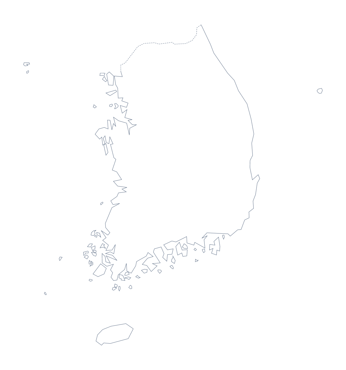
Blank map of South Korea
The outline, free as a PNG, SVG or PDF. Label it, colour it in or drop it into a slide.
Using a blank map of South Korea
People who want the shape of South Korea as a file are usually putting it into something of their own: a slide on a regional plan, a worksheet, a poster. There are two versions to take. Outline only is the country as one shape; With borders draws its 17 administrative areas. Each comes as a PNG on a transparent background, an SVG and a PDF.
For a designer's file
Open the SVG of With borders in Illustrator, Inkscape or Figma and each administrative area is its own path, so you can fill Seoul in a brand colour, soften the rest and leave Jeju as a separate shape in a contrasting tone. Because the SVG is a vector file it scales to a poster without blurring.
For a numbered quiz
The political blank map of South Korea is the With borders version. In a word processor, drop the PNG into a page, add numbers beside eight or nine areas and ask pupils to write each name in a column. Keep the list on this page as the answer sheet. Younger pupils can take the same PNG and colour each area in a different colour with no names at all.
On a slide
The PNG has a transparent background, so on a dark slide only the outline shows. Use Outline only when the slide is about the country as a whole and With borders when the areas matter, for instance with three of them filled in a highlight colour.
When more is needed
Names, pins or a title on the map call for Customise this map, which opens the same outline in the editor. Paper copies in black and white are on the printable map of South Korea.
How to do it in MapMaker
- Choose With borders for the 17 areas, or Outline only for the shape alone.
- Pick the PNG for a slide or worksheet, the SVG for a design tool or a PDF for A4 or Letter.
- Add numbers or filled areas to the file in your own program.
- Check answers against the list of areas below the map.
- Choose Customise this map for names or a title on the map itself.
The 17 administrative areas on the map
A key for labelling the map by hand.
- Busan
- Daegu
- Daejeon
- Gangwon
- Gwangju
- Gyeonggi
- Incheon
- Jeju
- North Chungcheong
- North Gyeongsang
- North Jeolla
- Sejong
- Seoul
- South Chungcheong
- South Gyeongsang
- South Jeolla
- Ulsan
Facts about South Korea
South Korea is in Eastern Asia. The capital is Seoul. The population is about 52 million (2019 estimate). South Korea has an area of about 98,500 km². The largest cities are Seoul, Busan, Incheon, Daegu and Daejeon. It borders North Korea. The map divides it into 17 administrative areas.
Maps of neighbouring places
Questions people ask
Is there a political blank map of South Korea?
Yes, the With borders version. It draws the lines between all 17 administrative areas and carries no names, so each can be labelled from the list further down the page.
Which file should I use in a worksheet, a slide or a design?
Use the PNG in a worksheet or a slide, because its transparent background takes the colour behind it. Use the SVG in Illustrator, Inkscape or Figma, and the PDF when you want A4 or Letter.
How many administrative areas does the blank map show?
The With borders version shows 17 administrative areas as separate shapes. Outline only shows the country as one shape with nothing drawn inside it.
Does the blank map show the names of the areas?
No. A blank map has no names, by design. For names on the map, choose Customise this map, turn them on in the editor and download from there.