Editable map of the Americas
Colour the countries, add cities and labels, and download it in minutes. Free, no sign-up.
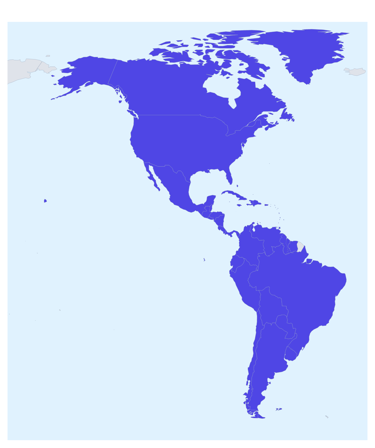
Ideas for a map of the Americas
A map of the Americas is the page behind a sales split, a list of offices, a long trip or a school project on a hemisphere. This one opens with 52 countries and territories drawn and ready to colour, so you start on the decisions rather than the outline.
Regions, offices and routes
A company selling across the Americas can split the map between sales teams: one colour for Canada and the United States of America, one for Mexico, Colombia and Peru, one for Brazil, Argentina and Chile. Add a legend with each team's name and the map becomes the territory slide for the next planning meeting.
An events or travel team can pin the cities on a multi-stop itinerary and draw a route with numbered stops. A family can colour the countries they have visited and leave the rest plain, and a class can give each country in a chosen region its own colour with the names shown.
Making it yours
With 52 shapes, some are too small to click, so use the bar on the map for the large ones and Customise this map for the rest: the place list names every country and territory, and a click on one opens a card with colours and Show names. Neighbours draws the surrounding countries in grey. Add your cities opens the pin tool with the city search ready.
Files, and slides
Download a PNG or JPG for a document, an SVG for Illustrator, Inkscape or Figma, or a PDF for print. In a board deck, set the canvas to 16:9, switch on Transparent for a slide with its own background and let two or three colours carry the message; Minimal keeps a business slide calm. The map for PowerPoint page covers decks in more detail. To focus on one part, start from the map of North America or the map of South America.
How to do it in MapMaker
- Pick a colour in the bar on the map and click the countries in each sales region or trip stage.
- Choose Customise this map to open the editor and pick small territories from the place list.
- Add pins with Find a city, join them with a route, and give the map a title and a legend on the Canvas tab.
- Choose Download and save a PNG for a slide or an SVG for a design tool.
Embed this map
Paste this code into your website to show this map of the Americas, with a small credit link back to MapMaker.so.
Facts about the Americas
52 members are on the map.
Maps of places in the Americas
Questions people ask
Which countries does the map of the Americas show?
The 52 countries and territories on the map, from Argentina and Canada to Mexico, Peru and the United States of America, with Cuba, Jamaica and Puerto Rico among them. The place list in the editor names every one.
How do I colour a small territory on the map of the Americas?
Choose Customise this map and pick the territory by name from the place list in the editor, which lists all 52. Bermuda and Aruba, for example, are quicker to find there than by clicking.
Can I colour the Americas by sales region instead of country by country?
Yes. Give each region one colour and click every country in it, for example Canada and the United States of America in one colour and Brazil and Argentina in another. Add a legend and rename each colour under Legend labels in the Data panel.
Can I draw a route across the Americas?
Yes. Pin each stop with Find a city in the editor and join the pins with the Route tool. Numbered stops show the order, and a plane icon can be switched on for a long flight between countries.