Printable map of UK counties and council areas
Free PDFs, ready for A4 or Letter. Print in colour or black and white.
Printing a map of UK counties and council areas
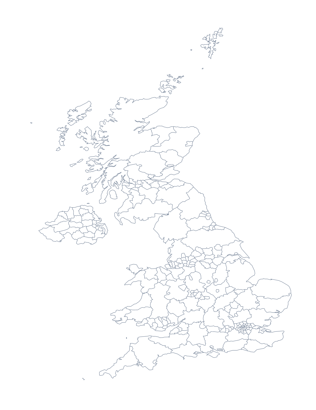
With 232 administrative areas, the version with regions of this map is a dense sheet, and it pays to decide what the sheet is for before you print it. With regions draws every area with no names; Blank outline gives the shape of the UK with nothing inside it. Both are free PDFs for A4 or Letter, in colour or black and white.
Using the dense sheet
Few tasks need all 232 areas at once, so pick a handful. Ask pupils to find and colour Cornwall, Kent, Norfolk, Gwynedd and Highland, then label them from the list further down this page. A local-history project can colour the area the school sits in and the ones around it. A family-history sheet can colour where each branch lived, with a key down the margin, and a trip planner can shade the areas on the route and add a few dates beside them.
Younger children get more from the blank outline: colour the whole shape, then place dots for London, Birmingham, Manchester, Leeds and Sheffield and write each name beside its dot, with an atlas to help.
Getting a legible print
Black and white at 100% gives the sharpest lines, and a pencil works better than a felt tip on the small areas. Laminate a copy and pupils can rub out and try again with a dry-wipe pen. A4 is fine for a handful of areas; if everyone needs to read the shapes, choose Customise before printing and download an A3 PDF from the editor. For the country on its own, see the printable map of the United Kingdom.
How to do it in MapMaker
- Choose With regions for the 232 administrative areas, or Blank outline for the shape of the UK.
- Pick A4 or Letter, then Black and white for sharp lines.
- Print the PDF at 100%, and number only the areas the task needs.
- Colour a few areas with the bar on the map and choose Download your map for a prepared sheet.
- Choose Customise before printing for A3, names or a title.
The 232 administrative areas on the map
A key for labelling the map by hand.
- Aberdeen
- Aberdeenshire
- Anglesey
- Angus
- Antrim
- Ards
- Argyll and Bute
- Armagh
- Ballymena
- Ballymoney
- Banbridge
- Barking and Dagenham
- Barnet
- Barnsley
- Bath and North East Somerset
- Bedford
- Belfast
- Bexley
- Birmingham
- Blackburn with Darwen
- Blackpool
- Blaenau Gwent
- Bolton
- Bournemouth
- Bracknell Forest
- Bradford
- Brent
- Bridgend
- Brighton and Hove
- Bristol
- Bromley
- Buckinghamshire
- Bury
- Caerphilly
- Calderdale
- Cambridgeshire
- Camden
- Cardiff
- Carmarthenshire
- Carrickfergus
- Castlereagh
- Central Bedfordshire
- Ceredigion
- Cheshire East
- Cheshire West and Chester
- Clackmannanshire
- Coleraine
- Conwy
- Cornwall
- Coventry
- Craigavon
- Croydon
- Cumbria
- Darlington
- Denbighshire
- Derby
- Derbyshire
- Derry
- Devon
- Doncaster
- Dorset
- Down
- Dudley
- Dumfries and Galloway
- Dundee
- Dungannon and South Tyrone
- Durham
- Ealing
- East Ayrshire
- East Dunbartonshire
- East Lothian
- East Renfrewshire
- East Riding of Yorkshire
- East Sussex
- Edinburgh
- Enfield
- Essex
- Falkirk
- Fermanagh
- Fife
- Flintshire
- Gateshead
- Glasgow
- Gloucestershire
- Greenwich
- Gwynedd
- Hackney
- Halton
- Halton
- Hammersmith and Fulham
- Hampshire
- Haringey
- Harrow
- Hartlepool
- Havering
- Herefordshire
- Hertfordshire
- Highland
- Hillingdon
- Hounslow
- Inverclyde
- Isle of Wight
- Isles of Scilly
- Islington
- Kensington and Chelsea
- Kent
- Kingston upon Hull
- Kingston upon Thames
- Kirklees
- Knowsley
- Lambeth
- Lancashire
- Larne
- Leeds
- Leicester
- Leicestershire
- Lewisham
- Limavady
- Lincolnshire
- Lisburn
- Liverpool
- London
- Luton
- Magherafelt
- Manchester
- Medway
- Merseyside
- Merthyr Tydfil
- Merton
- Mid Ulster
- Middlesbrough
- Midlothian
- Milton Keynes
- Monmouthshire
- Moray
- Moyle
- Neath Port Talbot
- Newcastle upon Tyne
- Newham
- Newport
- Newry and Mourne
- Newtownabbey
- Norfolk
- North Ayrshire
- North Down
- North East Lincolnshire
- North Lanarkshire
- North Lincolnshire
- North Somerset
- North Tyneside
- North Yorkshire
- Northamptonshire
- Northumberland
- Nottingham
- Nottinghamshire
- Oldham
- Omagh
- Orkney Islands
- Outer Hebrides
- Oxfordshire
- Pembrokeshire
- Perth and Kinross
- Peterborough
- Plymouth
- Poole
- Portsmouth
- Powys
- Reading
- Redbridge
- Redcar and Cleveland
- Renfrewshire
- Rhondda Cynon Taf
- Richmond upon Thames
- Rochdale
- Rotherham
- Rutland
- Salford
- Sandwell
- Scottish Borders
- Sefton
- Sheffield
- Shetland Islands
- Shropshire
- Slough
- Solihull
- Somerset
- South Ayrshire
- South Gloucestershire
- South Lanarkshire
- South Tyneside
- Southampton
- Southend-on-Sea
- Southwark
- Staffordshire
- Stirling
- Stockport
- Stockton-on-Tees
- Stoke-on-Trent
- Strabane
- Suffolk
- Sunderland
- Surrey
- Sutton
- Swansea
- Swindon
- Tameside
- Telford and Wrekin
- Thurrock
- Torbay
- Torfaen
- Tower Hamlets
- Trafford
- Vale of Glamorgan
- Wakefield
- Walsall
- Waltham Forest
- Wandsworth
- Warrington
- Warwickshire
- West Berkshire
- West Dunbartonshire
- West Lothian
- West Sussex
- Westminster
- Wigan
- Wiltshire
- Windsor and Maidenhead
- Wokingham
- Wolverhampton
- Worcestershire
- Wrexham
- York
Facts about UK counties and council areas
This map shows 232 administrative areas in Northern Europe. Together they have an area of about 243,000 km². The capital is London. The population is about 67 million (2019 estimate). The largest cities are London, Birmingham, Manchester, Leeds and Sheffield.
Questions people ask
How many areas does the printable map show?
The version with regions shows 232 administrative areas, each drawn as its own shape. The list further down this page names every one, so it works as the key when you mark a labelling task.
Will 232 areas print clearly on a home printer?
The PDFs are vector files, so the lines stay sharp, but small areas are close together on A4. Print in black and white at 100% for a sharp sheet, or use Customise before printing to download A3 for a wall.
Does the printable map show the names of the counties?
No. The PDFs carry no names, so pupils write them in. For names on the map, choose Customise before printing, select the areas you want named and download a PDF from the editor.
Can I print the outline without the areas?
Yes. Blank outline gives the shape of the UK with no lines inside it, which suits younger children or a project where only the country matters.