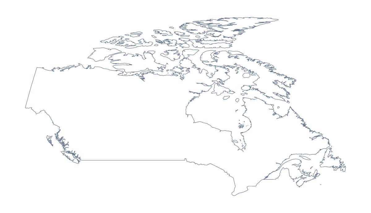
Blank map of Canada
The outline, free as a PNG, SVG or PDF. Label it, colour it in or drop it into a slide.
Using a blank map of Canada
Teachers use a blank map of Canada for lessons, and so do people making a report cover, a banner or a diagram of a service area. This page gives you the shape of Canada as a file. Outline only is the country on its own. With borders adds the 10 provinces and 3 territories. Each version is a PNG on a transparent background, an SVG or a PDF for A4 or Letter.
Reports, banners and diagrams
Place the PNG of Outline only on a cover page, with the title beside it. The background is transparent, so the shape takes the cover's colour. If the page is for a client with a brand palette, open the SVG in Illustrator, Inkscape or Figma and recolour the outline in the brand's colour.
For a diagram of coverage, take With borders and shade the provinces you serve in the design tool, leaving the rest as they are. The political blank map of Canada is this version, and because the lines are vectors in the SVG you can thicken the ones that matter.
On a slide
A talk about the country can reuse one PNG throughout: fill the provinces or territories each section covers with the shape tools of your slide software and leave the rest in a pale tint. The list on this page gives the 10 provinces and 3 territories by name for your captions.
For a lesson on the provinces alone, start from the blank map of Canadian provinces and territories, which leads with the divisions and links back to this page.
What next
The PDF is there for A4 or Letter if you need the shape on paper. For more print choices, use the printable map of Canada. When the map needs names, colours or a title, choose Customise this map.
How to do it in MapMaker
- Choose With borders for the provinces and territories, or Outline only for the country alone.
- Pick PNG for a cover or slide, SVG for a design tool or PDF, A4 or PDF, Letter.
- Place the file in your document and resize it from a corner so its proportions stay.
- Fill the provinces or territories your slide is about, and take their names from the list on this page.
- Choose Customise this map for names, neighbours or colours.
The 10 provinces and 3 territories on the map
A key for labelling the map by hand.
- Alberta
- British Columbia
- Manitoba
- New Brunswick
- Newfoundland and Labrador
- Northwest Territories
- Nova Scotia
- Nunavut
- Ontario
- Prince Edward Island
- Quebec
- Saskatchewan
- Yukon
Facts about Canada
Canada is in Northern America. The capital is Ottawa. The population is about 38 million (2019 estimate). Canada has an area of about 9,890,000 km². The largest cities are Toronto, Montréal, Vancouver, Ottawa and Calgary. It borders United States of America. The map divides it into 10 provinces and 3 territories.
Maps of neighbouring places
Questions people ask
Is there a political blank map of Canada?
Yes. The With borders version draws the 10 provinces and 3 territories inside the outline with no names, and it is the political blank map of Canada. Outline only is the shape of the country alone.
Is there a blank map of Canada's provinces on their own?
Yes. The blank map of Canadian provinces and territories leads with the divisions, as a PNG, an SVG or a PDF. Choose it when the divisions are the subject rather than the country as a whole.
Can I show the United States of America on the blank map?
Not on this page, where the map does not change. Choose Customise this map, switch on Neighbours in the editor to show the United States of America in grey and download from there.
Can I make the outline bigger without it going blurry?
Yes, using the SVG or the PDF. Both are vector files, so the outline of Canada and its provinces stay sharp at any size, from a cover page to a banner.