Blank map of Moldova
The outline, free as a PNG, SVG or PDF. Label it, colour it in or drop it into a slide.
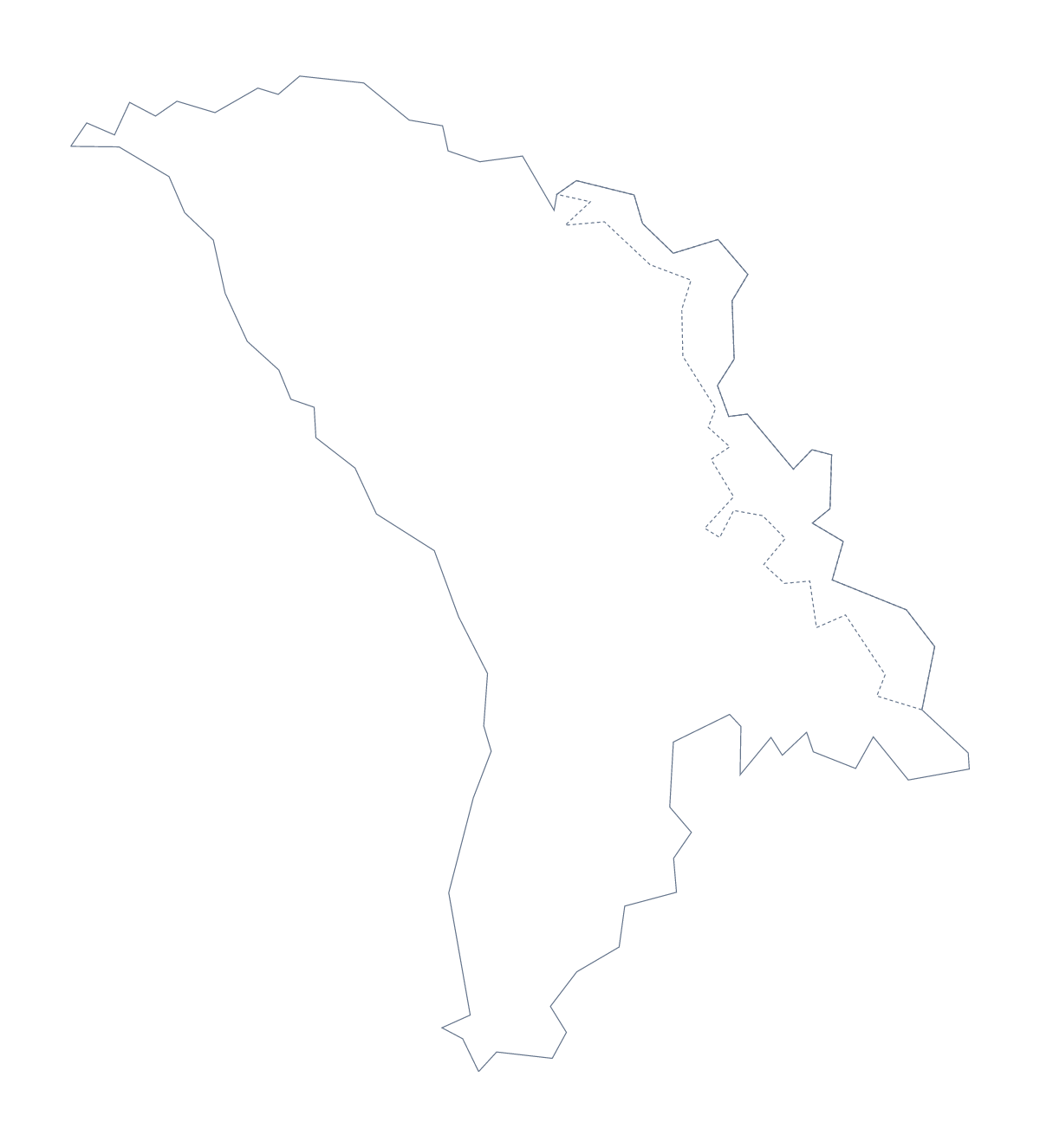
Using a blank map of Moldova
If you are building your own worksheet, revision card or slide about Moldova, this page gives you the shape to build on. Outline only is the country with nothing inside it, and With borders adds its 40 administrative areas. Each comes as a PNG, an SVG or a PDF.
On a slide or a poster
Place the PNG on a title slide and its transparent background lets your own colour show around the country. In Illustrator, Inkscape or Figma the SVG keeps its lines sharp at any size, so you can trace it for a poster, give it a heavy line for a report cover or recolour the areas in a brand palette.
A numbered quiz
Open With borders in a word processor, put small numbered boxes beside a handful of areas, such as Edineț, Hîncești and Drochia, and keep the list further down this page as the answer sheet. For a quicker warm-up, show Outline only on a slide with no title and ask which country it is.
Which version
The political blank map of Moldova is the With borders version: the area lines and no names. Outline only is the better choice for a silhouette, a logo sketch or younger children, where inner lines get in the way. The PDF prints at 100% on A4 or Letter as it stands; for black and white or other print choices, use the printable map of Moldova. For names, colours or a title, Customise this map opens the same outline in the editor.
How to do it in MapMaker
- Pick With borders for the 40 areas, or Outline only for the shape of the country.
- Download the PNG for a slide or worksheet, the SVG for a design tool or a PDF for A4 or Letter.
- Drop the file onto your page, number the areas for your quiz and check answers against the list on this page.
- Choose Customise this map when the outline needs names, colours or a title.
The 40 administrative areas on the map
A key for labelling the map by hand.
- Anenii Noi
- Bălți
- Basarabeasca
- Bender
- Briceni
- Cahul
- Călărași
- Camenca
- Cantemir
- Căușeni
- Chișinău
- Cimișlia
- Comrat
- Criuleni
- Dondușeni
- Drochia
- Edineț
- Fălești
- Florești
- Glodeni
- Grigoriopol
- Hîncești
- Ialoveni
- Leova
- Nisporeni
- Ocnița
- Orhei
- Rezina
- Rezina
- Rîșcani
- Sîngerei
- Șoldănești
- Soroca
- Ștefan Vodă
- Strășeni
- Taraclia
- Telenești
- Transnistria
- Transnistria
- Ungheni
Facts about Moldova
Moldova is in Eastern Europe. The capital is Chișinău. The population is about 2.7 million (2019 estimate). Moldova has an area of about 33,100 km². The largest cities are Chișinău, Tiraspol, Bălți, Cahul and Dubăsari. It borders Romania and Ukraine. The map divides it into 40 administrative areas.
Maps of neighbouring places
Questions people ask
Is there a political blank map of Moldova?
Yes. With borders is the political blank map of Moldova: it draws the 40 administrative areas with no names on them. Outline only has no inner lines at all.
Does the PNG have a transparent background?
Yes. Everything around the outline is see-through, so the map of Moldova takes the colour of the slide, worksheet or poster you place it on.
Is there an answer key for a labelling quiz?
Yes. The list of administrative areas further down this page names all 40 that With borders draws. Number the ones you want pupils to find and check their answers against it.
Can I show Romania and Ukraine around Moldova?
Not on this page, which gives only the shape of Moldova. Open the editable map of Moldova, where the Neighbours switch greys in the countries around it.