Blank map of Nepal
The outline, free as a PNG, SVG or PDF. Label it, colour it in or drop it into a slide.
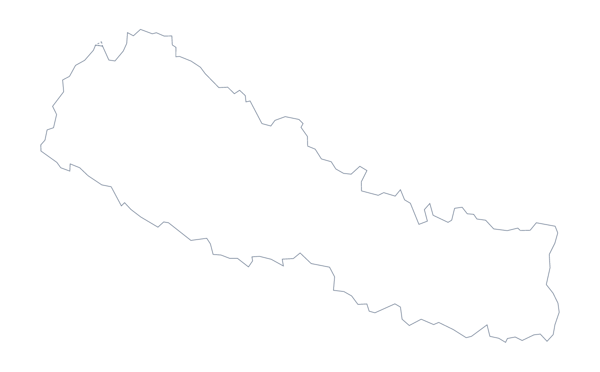
Using a blank map of Nepal
Nepal as a plain shape is useful for lots of small jobs: a worksheet header, a trek poster, a slide on a project. Each version comes as a PNG on a transparent background, an SVG and a PDF. Outline only is the shape alone, and With borders draws its 14 administrative areas.
In a worksheet or a quiz
Put the With borders PNG in a word-processor page and number five areas for pupils to name, perhaps Lumbini Zone, Narayani Zone, Sagarmatha Zone, Mahakali Zone and Dhaulagiri Zone. The list further down this page is the answer sheet. For a younger class, use Outline only as a cover for the worksheet pack, with the title set across it.
On a slide or a poster
Place the PNG on a slide with a coloured background; because it is transparent, only the shape shows. For a poster, the SVG can be recoloured in a design tool and enlarged to any size, while keeping crisp edges. Stack the outline behind a block of text for a section title in a report.
A note on the two versions
The political blank map of Nepal is the With borders version, which includes inner lines and so is best for labelling and colouring by area. Choose Outline only when inner lines would distract, such as behind a headline or a logo sketch.
Next steps
If you need names, colours or pins, Customise this map opens the same outline in the editor. The printable map of Nepal has the print options, and the choropleth map of Nepal colours the areas from your data.
How to do it in MapMaker
- Choose Outline only for the shape, or With borders for the 14 areas.
- Download the PNG for a slide or worksheet, or the SVG for a design tool.
- Place the file on your page; its transparent background keeps your own colour.
- For names or a title, choose Customise this map and download from the editor.
The 14 administrative areas on the map
A key for labelling the map by hand.
- Bagmati Zone
- Bheri Zone
- Bhojpur
- Dhaulagiri Zone
- Gandaki Zone
- Janakpur Zone
- Karnali Zone
- Lumbini Zone
- Mahakali Zone
- Mechi Zone
- Narayani Zone
- Rapti Zone
- Sagarmatha Zone
- Seti Zone
Facts about Nepal
Nepal is in Southern Asia. The capital is Kathmandu. The population is about 29 million (2019 estimate). Nepal has an area of about 147,000 km². The largest cities are Kathmandu, Lalitpur, Hetauda, Pokhara and Biratnagar. It borders China and India. The map divides it into 14 administrative areas.
Maps of neighbouring places
Questions people ask
What is the difference between Outline only and With borders?
Outline only is the shape of Nepal with nothing inside it. With borders draws the lines of the 14 administrative areas, with no names, so it suits labelling and colouring by area.
Is there a political blank map of Nepal?
Yes, the With borders version is the political blank map of Nepal. It has 14 areas and no names, and the list further down this page is the key.
Does the PNG have a transparent background?
Yes. Both PNG files have no background colour, so the map takes the colour of the slide, page or poster you place it on.
Can I make the outline bigger without it going blurry?
Yes. The SVG and PDF files are vector, so the outline and its areas stay sharp at any size. The PNG is for ordinary use on a slide or document.