Blank map of Panama
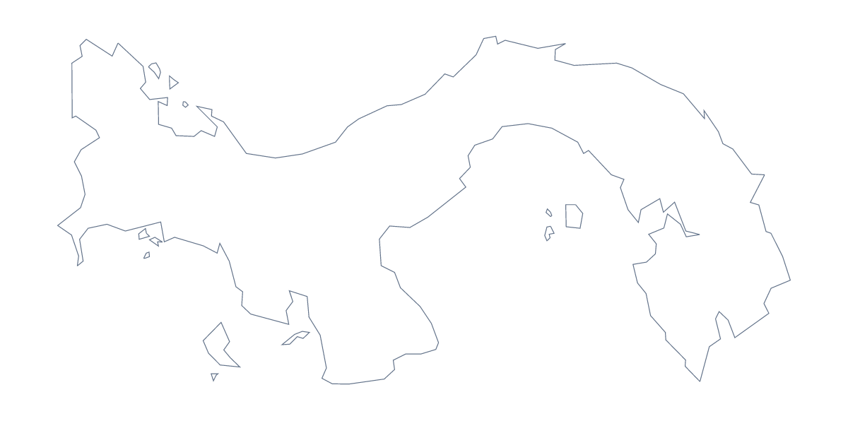
The outline, free as a PNG, SVG or PDF. Label it, colour it in or drop it into a slide.
Using a blank map of Panama
The shape of Panama turns up in all sorts of homemade material: a trade report cover, a slide on Central America, a poster for a language week, a regional briefing. This page hands over that shape as a file. Outline only is the country alone, and With borders shows the 12 administrative areas inside it; every version is a PNG, an SVG or a PDF.
A regional report
Place the With borders PNG on the first page of a report and run your own text beside it, or repeat it small at the head of each section with that section's areas filled. The 12 areas are few enough to colour by section, and the list further down this page gives the names, Veraguas, Herrera, Los Santos and Darién among them. For a talk on the same subject, the transparent PNG sits on the deck's colour, so the report and the slides can share one picture.
Design and slides
On a slide, the PNG's transparent background lets Panama take the colour of the deck, so only the shape shows. In a design tool, the SVG can be recoloured area by area for a brand map, traced for an illustration or cut for a craft project.
Choosing
The political blank map of Panama is the With borders version: 12 shapes and no names, the one for areas filled by section. Outline only suits covers, younger children and silhouettes. For printing choices go to the printable map of Panama, and for names or colours choose Customise this map.
How to do it in MapMaker
- Pick With borders for the 12 administrative areas, or Outline only for the shape alone.
- Download the PNG for a slide or worksheet, or the SVG for a design tool.
- Drop the file onto your page and scale it from a corner.
- Fill the areas each section covers and take the names from the list on this page.
- Choose Customise this map to add names, colours or a title.
The 12 administrative areas on the map
A key for labelling the map by hand.
- Chiriquí
- Coclé
- Colón
- comarca Ngäbe-Buglé
- Darién
- Emberá-Wounaan Comarca
- Guna Yala
- Herrera
- Los Santos
- Ngöbe-Buglé Comarca
- Panamá
- Veraguas
Facts about Panama
Panama is in Central America. The capital is Panama City. The population is about 4.2 million (2019 estimate). Panama has an area of about 74,800 km². The largest cities are Panama City, Colón, David, Balboa and Santiago. It borders Colombia and Costa Rica. The map divides it into 12 administrative areas.
Maps of neighbouring places
Questions people ask
What is the difference between Outline only and With borders?
Outline only is the shape of Panama with nothing inside it. With borders adds the lines of its 12 administrative areas, as separate shapes. Neither version carries a single name.
Which file should I use in a worksheet, a slide or a design?
Use the PNG in a worksheet or slide, since its transparent background takes the colour behind it. Use the SVG in Illustrator, Inkscape or Figma, and the PDF when you want to print on A4 or Letter.
Can I make the outline bigger without it going blurry?
Use the SVG or the PDF. Both are vector files, so the outline of Panama and its area lines stay sharp whether it fills a phone screen or a classroom wall. The PNG is a fixed-size picture.
Can I colour the map in before I download it?
Not on this page, which does not change the map. Choose Customise this map to colour areas in the editor, or use the printable page, whose bar on the map colours areas before printing.