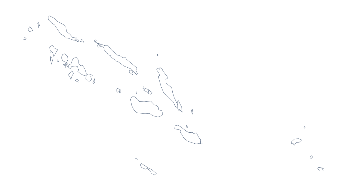
Blank map of the Solomon Islands
The outline, free as a PNG, SVG or PDF. Label it, colour it in or drop it into a slide.
Using a blank map of the Solomon Islands
A blank map of the Solomon Islands goes into the middle of other work: a planning slide, a worksheet of your own, a handout that needs a locator image. This page gives you the shape as a file in two versions. Outline only has nothing inside it, and With borders adds the lines between its 10 administrative areas. Both are available as a PNG, an SVG or a PDF.
A slide that needs a locator
When a deck covers a project in one part of the country, the transparent PNG can sit in a corner as a locator. It takes your slide's colour, so no white block appears, and you can add your own highlight on top in the slide software. Use With borders when the audience needs to see the areas, and Outline only when the shape alone will do.
Picking out one area
For a report on the work in one area, set With borders in a document and fill that area with your word processor's shape tools. The list further down this page gives each area's name, such as Guadalcanal, Isabel or Temotu, for the caption. A deck can repeat the same map on each slide, with a different area filled each time.
Picking the file
The SVG is the choice for a design tool, since it can be enlarged and recoloured without blurring, and a report cover can use it large with the title across it. The PDF is for printing on A4 or Letter as it is. If you want the printing choices, colour or black and white, see the printable map of the Solomon Islands.
How to do it in MapMaker
- Choose With borders to show the 10 administrative areas, or Outline only for the plain shape.
- Pick PNG for a slide or a worksheet, SVG for a design tool or a PDF for A4 or Letter.
- Place the PNG as a locator in a corner of your slide, and resize it from a corner.
- Fill the area your report covers and copy its name from the list on this page.
- Choose Customise this map for names, colours, pins or a title.
The 10 administrative areas on the map
A key for labelling the map by hand.
- Central
- Choiseul
- Guadalcanal
- Honiara
- Isabel
- Makira-Ulawa
- Malaita
- Rennell and Bellona
- Temotu
- Western
Facts about the Solomon Islands
The Solomon Islands is in Melanesia. The capital is Honiara. The population is about 670,000 (2019 estimate). The Solomon Islands has an area of about 27,300 km². The largest cities are Honiara, Gizo and Lata. Across the sea, its neighbours include Papua New Guinea and Vanuatu. The map divides it into 10 administrative areas.
Maps of neighbouring places

Questions people ask
What is the difference between Outline only and With borders?
Outline only is the shape of the Solomon Islands with nothing inside it. With borders adds the lines of all 10 administrative areas. Neither version has a name on it.
Is there a political blank map of the Solomon Islands?
Yes: the With borders version is the political blank map, with all 10 administrative areas drawn in and no labels. The list further down this page gives each area's name for marking answers.
Does the PNG have a transparent background?
Yes. Everything around the outline is see-through, so the map takes on the colour of your slide, document or card and no white box appears behind it.
How do I add names, a title or my own colours?
Choose Customise this map. The editor opens the same outline, where you can show names, colour areas, add pins and a title, then download a PNG, JPG, SVG or a PDF.