Editable map of Canadian provinces and territories
Colour the regions, add cities and labels, and download it in minutes. Free, no sign-up.
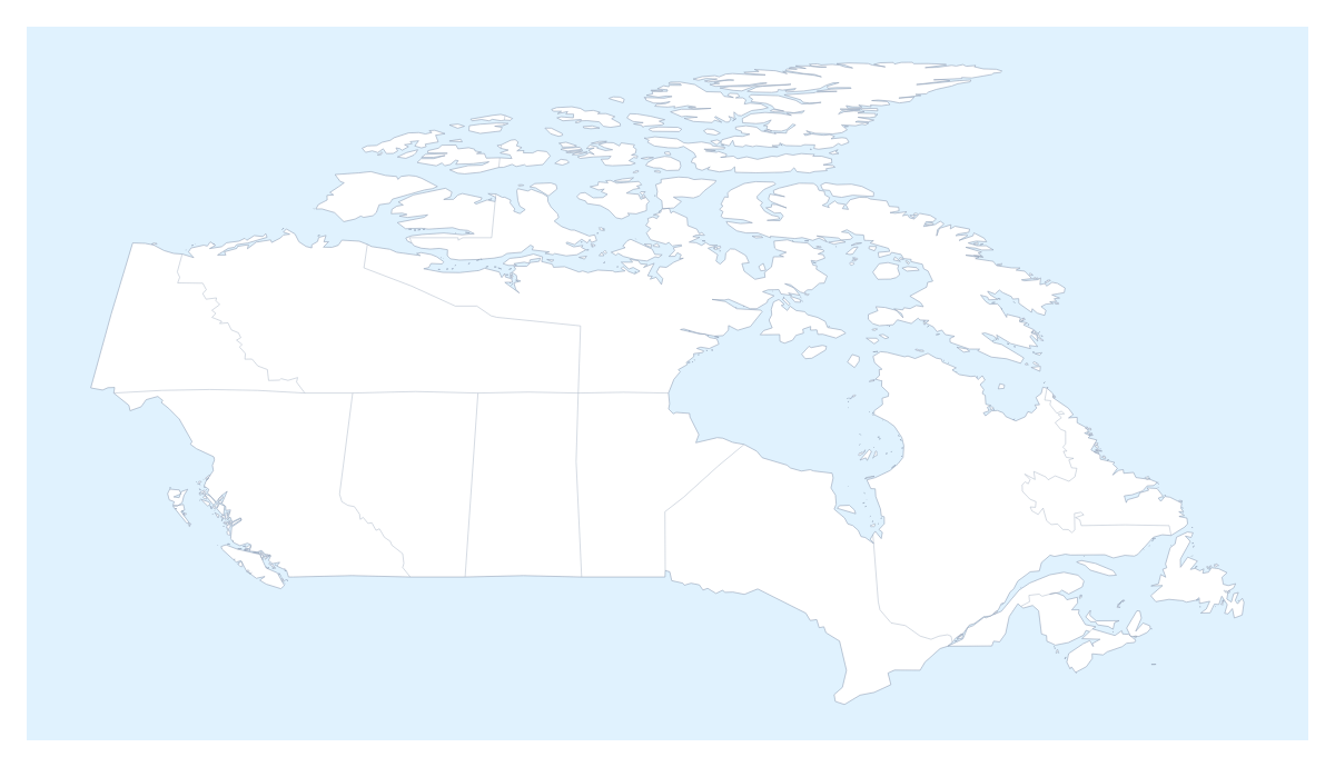
Ideas for a map of Canadian provinces and territories
A map of the Canadian provinces and territories is the base for anything with a boundary in it: the area a service covers, the part of the country a report is about, or what a class has learned so far. This one opens in the editor with 10 provinces and 3 territories already drawn, so your time goes on colours and labels rather than on tracing an outline.
Coverage, teams and offices
A company can colour the provinces and territories it serves in one colour and leave the rest grey, which shows a service area faster than a list. A sales manager can give each team its own colour, click the provinces it looks after and add a legend with the team leads' names. Pin Toronto, Montréal, Vancouver, Ottawa and Calgary for offices or depots, and one slide shows who covers what and where they sit. The country's own page, the editable map of Canada, opens with the same divisions.
Lessons and trips
Pupils can colour the provinces one lesson at a time, show the names of the ones they have learned and save Nunavut, Yukon and the Northwest Territories for the end. For a trip, pin Vancouver, Calgary and Toronto with the city search and join them with a route: numbered stops give the order at a glance, and a plane icon can be switched on for a flight.
Making it yours
Start with the bar on the map: pick a colour, click and switch on Neighbours if the United States of America should show beside the provinces. In the editor, opened with Customise this map, the place list names every province and territory, which is quicker than hunting for Prince Edward Island on a small shape. Add your cities opens the pin tool, and Add a title puts the cursor in the title field. Minimal suits a report and Vintage a poster.
Into a deck
For a slide, set the canvas to 16:9. In the Download dialog, choose PNG with Transparent on if the slide has its own background, or Copy image to paste the map straight into PowerPoint, Google Slides or Keynote. A coverage slide reads best with two or three colours and a short legend; the map for PowerPoint page has more. Choose SVG when a designer will restyle it in Illustrator, Inkscape or Figma. For blank copies on paper, use the printable map of Canadian provinces and territories.
How to do it in MapMaker
- Pick a colour in the bar on the map and click the provinces and territories you want, with Neighbours on if the United States of America should show.
- Choose Customise this map to carry on in the editor, where the place list names every province and territory.
- Drop pins for Toronto, Calgary or Vancouver with Find a city, and add a title on the Canvas tab.
- Choose Download and save a PNG for slides, with Transparent on for a coloured background, or an SVG for a design tool.
Embed this map
Paste this code into your website to show this map of Canadian provinces and territories, with a small credit link back to MapMaker.so.
Facts about Canadian provinces and territories
This map shows 10 provinces and 3 territories in Northern America. Together they have an area of about 9,890,000 km². The capital is Ottawa. The population is about 38 million (2019 estimate). The largest cities are Toronto, Montréal, Vancouver, Ottawa and Calgary.
Questions people ask
How do I colour the Canadian provinces and territories?
Pick a colour in the bar on the map and click a province or territory to fill it; click it again to clear it. Choose Customise this map to work from the place list instead, which names all 10 provinces and 3 territories, from Alberta to Yukon.
Can I group the provinces and territories into sales regions?
Yes. Give each region one colour and click every province or territory it covers. The legend gets one line per colour, and you can rename the lines under Legend labels in the Data panel, for example with a manager's name or a depot.
Can I add Toronto, Montréal or Vancouver to the map?
Yes. Add your cities opens the pin tool with Find a city ready: type Toronto, Montréal, Vancouver, Ottawa or Calgary and the pin drops on it. You can rename a pin to the name of your own office.
How do I show the countries around the provinces?
Switch on Neighbours in the bar on the map and the United States of America appears in grey beside the provinces and territories. It helps on a slide about cross-border deliveries or a route that leaves the country.