Printable map of Canadian provinces and territories
Free PDFs, ready for A4 or Letter. Print in colour or black and white.
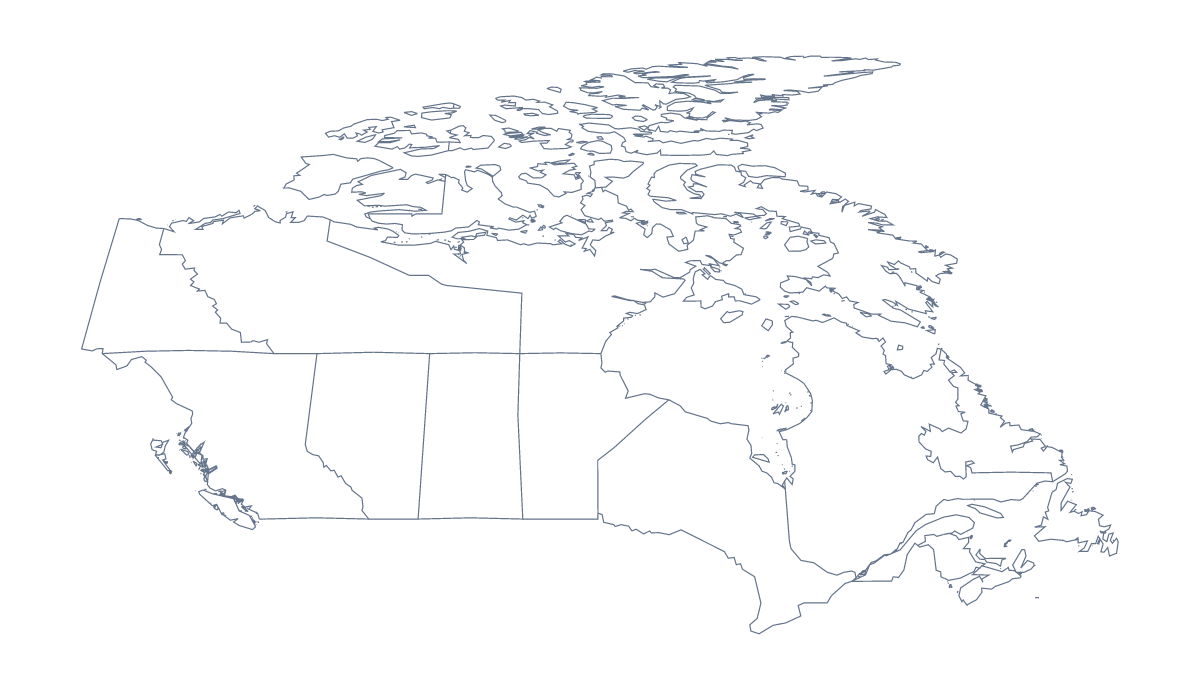
Printing a map of Canadian provinces and territories
A printable map of the Canadian provinces and territories gets used at the front of a classroom, on a kitchen table and in a folder for a trip. There are two PDFs: With regions draws all 10 provinces and 3 territories, and Blank outline is the shape of the country with nothing inside it. Neither has names printed, which leaves the labelling to whoever holds the pen.
Ideas for a class
Younger children can colour the province they live in, then the ones a relative lives in, and draw a dot for Ottawa with its name beside it. If an atlas is on the desk, they can add Toronto, Montréal, Vancouver and Calgary the same way.
Older pupils can fill in every province and territory from the list further down this page, which doubles as the answer key, then swap sheets and mark each other's. For group work, give each group three or four provinces to research, colour and label, and pin the sheets together as one wall map. Nunavut, Yukon and the Northwest Territories make a good extra round for the quickest group.
Choosing and printing
Use With regions for labelling, quizzes and colouring by a rule, because each province and territory is its own shape. Use Blank outline when pupils will draw the lines themselves. Black and white suits a class set that will be photocopied; colour suits a single copy. Print at 100% when copies must match, or choose fit to page if the edges are cut off.
To colour a few provinces before printing, use the bar on the map, then Download your map. For the country alone, there is also the printable map of Canada, and for names or A3, Customise before printing opens the editor.
How to do it in MapMaker
- Choose With regions to print the 10 provinces and 3 territories, or Blank outline for the country's shape alone.
- Pick A4 or Letter, then Black and white for a class set or Colour for a single copy.
- Open the PDF and print it at 100%, so every copy matches the last.
- Colour a few provinces with the bar on the map, and Download your map saves a PDF with those colours.
- Choose Customise before printing for names, a title or A3.
The 10 provinces and 3 territories on the map
A key for labelling the map by hand.
- Alberta
- British Columbia
- Manitoba
- New Brunswick
- Newfoundland and Labrador
- Northwest Territories
- Nova Scotia
- Nunavut
- Ontario
- Prince Edward Island
- Quebec
- Saskatchewan
- Yukon
Facts about Canadian provinces and territories
This map shows 10 provinces and 3 territories in Northern America. Together they have an area of about 9,890,000 km². The capital is Ottawa. The population is about 38 million (2019 estimate). The largest cities are Toronto, Montréal, Vancouver, Ottawa and Calgary.
Questions people ask
How many provinces and territories does the printable map show?
The version with regions shows 10 provinces and 3 territories, each as its own shape. The list further down this page names them all, so it works as the key when you check a labelling sheet.
Can I print the map of the Canadian provinces and territories in black and white?
Yes. Choose Black and white before you open the PDF, and both versions come out in greys and black lines that photocopy well. Pick A4 or Letter at the same time.
Can I mark Ottawa, Toronto and Vancouver on it?
Mark them by hand: the PDFs carry no city names, so pupils can place Ottawa, Toronto, Montréal, Vancouver and Calgary themselves. For printed pins and names, choose Customise before printing and add them in the editor.
Can I print it on A3 for a wall?
Not from this page, which offers A4 and Letter. Choose Customise before printing, and the editor can download a PDF on A3 for a wall display.