Printable map of the Caribbean
Free PDFs, ready for A4 or Letter. Print in colour or black and white.
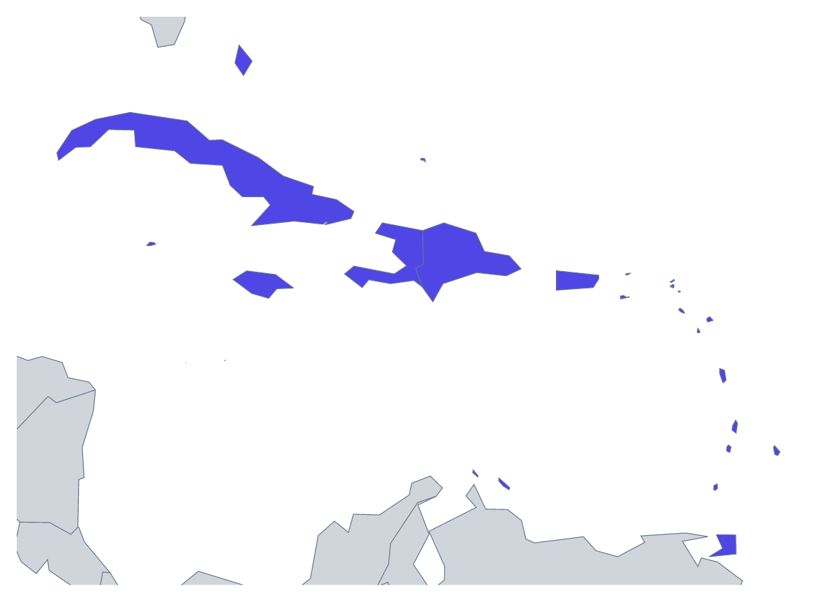
Printing a map of the Caribbean
Teachers print the Caribbean for a unit on the region, a quiz or a display, and families print it to plan a holiday. The page has two versions, both PDFs for A4 or Letter, in colour or black and white, with no names printed: With country borders, which draws all 25 countries and territories, and a Blank outline of the region.
Finding small places
Many of the 25 are small on a sheet of paper, which makes the map a good search game. Give a pupil five names from the list further down this page, such as Cuba, Jamaica, Haiti, Barbados and Puerto Rico, and ask them to find and ring each one, then write the name beside it. For a harder round, number ten of the smaller ones and ask for the names from memory.
Younger children can colour five or six members in bright colours and add a compass rose. Older pupils can shade the members that fit a rule you set, such as every name that starts with Saint, and add a key. For a holiday plan, print a copy, mark the places you will visit and draw the route between them in pencil.
Version, paper and size
With country borders is the version for labelling and for any task about individual members. The Blank outline shows the region without the lines between them. Choose black and white for a class set and colour for a single copy. The smallest members are tiny on A4 or Letter, so for a display choose Customise before printing and download an A3 PDF there. To shade some members first, use the bar on the map and then Download your map.
If you want the outline as an image for your own worksheet, the blank map of the Caribbean comes as a PNG, an SVG or a PDF.
How to do it in MapMaker
- Choose With country borders for the 25 countries and territories, or Blank outline for the region alone.
- Pick A4 or Letter, and Black and white if the sheet will be photocopied.
- Open the PDF and print it at 100% so the small shapes keep their proportions.
- Shade any members a lesson needs with the bar on the map, then choose Download your map.
- Choose Customise before printing for names, a title or an A3 sheet.
The 25 members on the map
A key for labelling the map by hand.
- Anguilla
- Antigua and Barbuda
- Aruba
- Bahamas
- Barbados
- British Virgin Islands
- Cayman Islands
- Cuba
- Curaçao
- Dominica
- Dominican Republic
- Grenada
- Haiti
- Jamaica
- Montserrat
- Puerto Rico
- Saint Barthélemy
- Saint Kitts and Nevis
- Saint Lucia
- Saint Martin
- Saint Vincent and the Grenadines
- Sint Maarten
- Trinidad and Tobago
- Turks and Caicos Islands
- United States Virgin Islands
Facts about the Caribbean
25 members are on the map.
Maps of places in the Caribbean

Questions people ask
Which countries are on the printable map of the Caribbean?
The 25 countries and territories on the map. The list further down this page names every one, so it doubles as the answer key for a labelling sheet or a quiz.
Will the smaller members show up when I print?
On A4 or Letter the smallest are hard to make out. For a display sheet, choose Customise before printing and download the same map as an A3 PDF, which gives them more room.
Can I make copies for my class?
Yes. The PDFs are free, so print as many as the class needs. Choose Black and white if you will photocopy, since members you shade then print as greys.
How do I check pupils' answers?
Number some members on a blank copy, then read the names from the list further down this page, which gives all 25, as pupils swap papers to mark.