Blank map of the Caribbean
The outline, free as a PNG, SVG or PDF. Label it, colour it in or drop it into a slide.
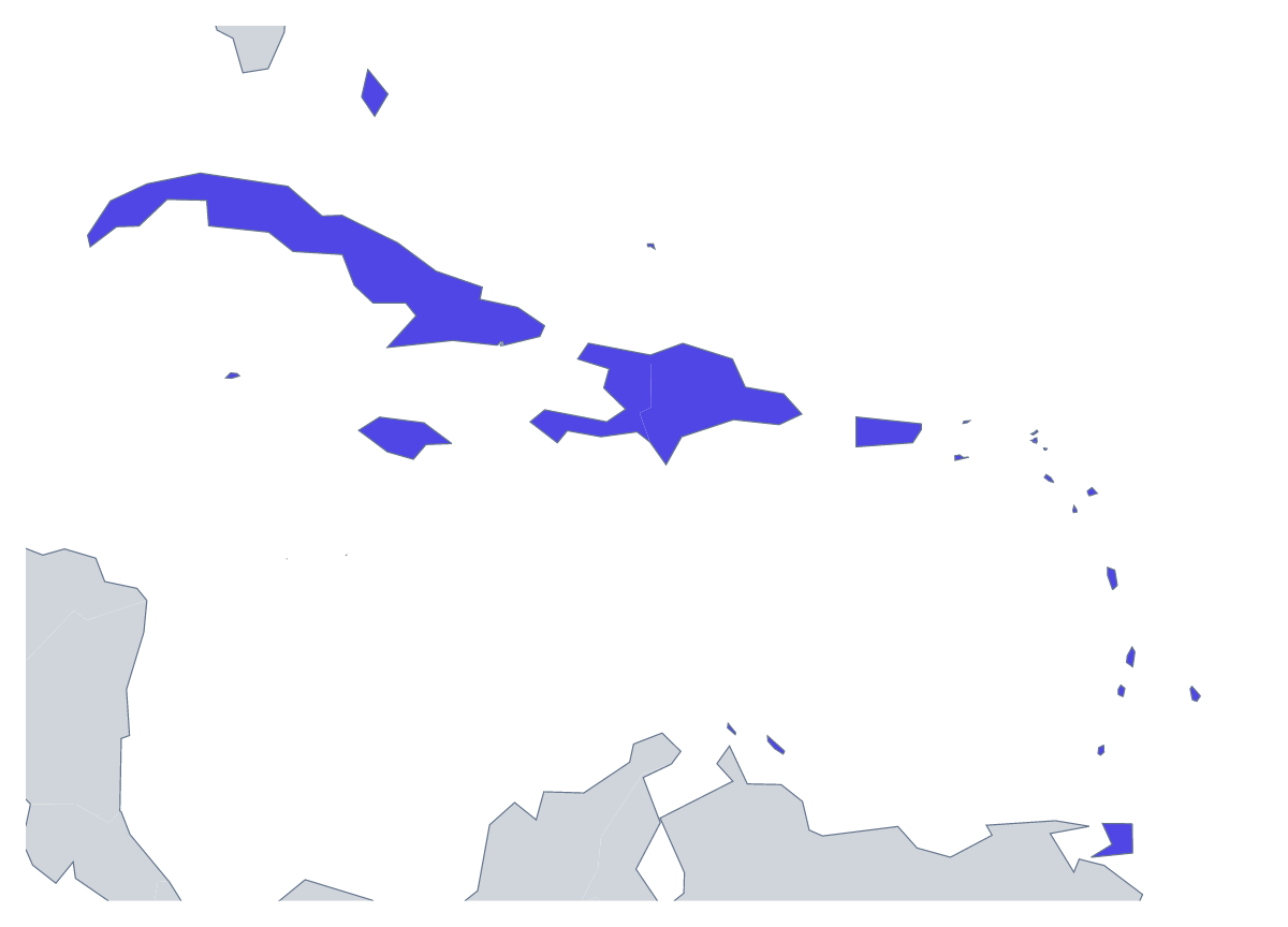
Using a blank map of the Caribbean
The blank Caribbean tends to be wanted for something with a layout of its own: a travel poster, a hotel group's website, a cruise brochure, a magazine page, a worksheet. With borders draws the 25 countries and territories as separate shapes; Outline only keeps the region as one piece of land. Each comes as a PNG on a transparent background, an SVG or a PDF.
Posters and websites
A transparent PNG sits over a photograph or a block of colour without a white box, so the region can go into a page header or onto a poster. The SVG goes into Illustrator, Inkscape or Figma, where a designer can fill the handful of members a campaign is about, give the rest a pale tint and add the markers for hotels, offices or ports.
A brochure page
Paste the PNG into a page for a hotel group or a cruise brochure and fill the handful of members a package covers in one colour, leaving the rest pale. Because the members are separate shapes in With borders, the same file can carry a different highlight on every page. The list further down this page gives the spelling of each member.
Version and file
With borders is the political blank map of the Caribbean, and the one to choose whenever the members need telling apart. Outline only is the silhouette for an icon or a faint backdrop. PNG suits documents and slides, SVG suits design, and the PDF prints on A4 or Letter. When the names matter, Customise this map opens the same outline in the editor, where you can show names, colour members and add a title before you download. For print choices such as black and white, see the printable map of the Caribbean.
How to do it in MapMaker
- Choose With borders for the 25 countries and territories, or Outline only for the land as one shape.
- Download the PNG for a poster, a page or a worksheet, or the SVG for a design tool.
- Pick PDF, A4 or PDF, Letter for a sheet that goes to a printer as it is.
- Open Customise this map to add names, colours, pins or a title, then download from the editor.
The 25 members on the map
A key for labelling the map by hand.
- Anguilla
- Antigua and Barbuda
- Aruba
- Bahamas
- Barbados
- British Virgin Islands
- Cayman Islands
- Cuba
- Curaçao
- Dominica
- Dominican Republic
- Grenada
- Haiti
- Jamaica
- Montserrat
- Puerto Rico
- Saint Barthélemy
- Saint Kitts and Nevis
- Saint Lucia
- Saint Martin
- Saint Vincent and the Grenadines
- Sint Maarten
- Trinidad and Tobago
- Turks and Caicos Islands
- United States Virgin Islands
Facts about the Caribbean
25 members are on the map.
Maps of places in the Caribbean

Questions people ask
Is there a political blank map of the Caribbean?
Yes, the With borders version. Each of the 25 countries and territories appears as its own unnamed shape, which suits a labelling exercise or a poster where a few members are filled.
Which countries are on the blank map of the Caribbean?
The 25 countries and territories on the map, from Anguilla to the United States Virgin Islands. The list further down this page names them all and works as the key for a labelling quiz.
Can I print the blank map of the Caribbean?
Yes. The PDF is made for A4 or Letter and prints as it is. For choices such as black and white, the printable page of the Caribbean has them.