Printable map of Central Asia
Free PDFs, ready for A4 or Letter. Print in colour or black and white.
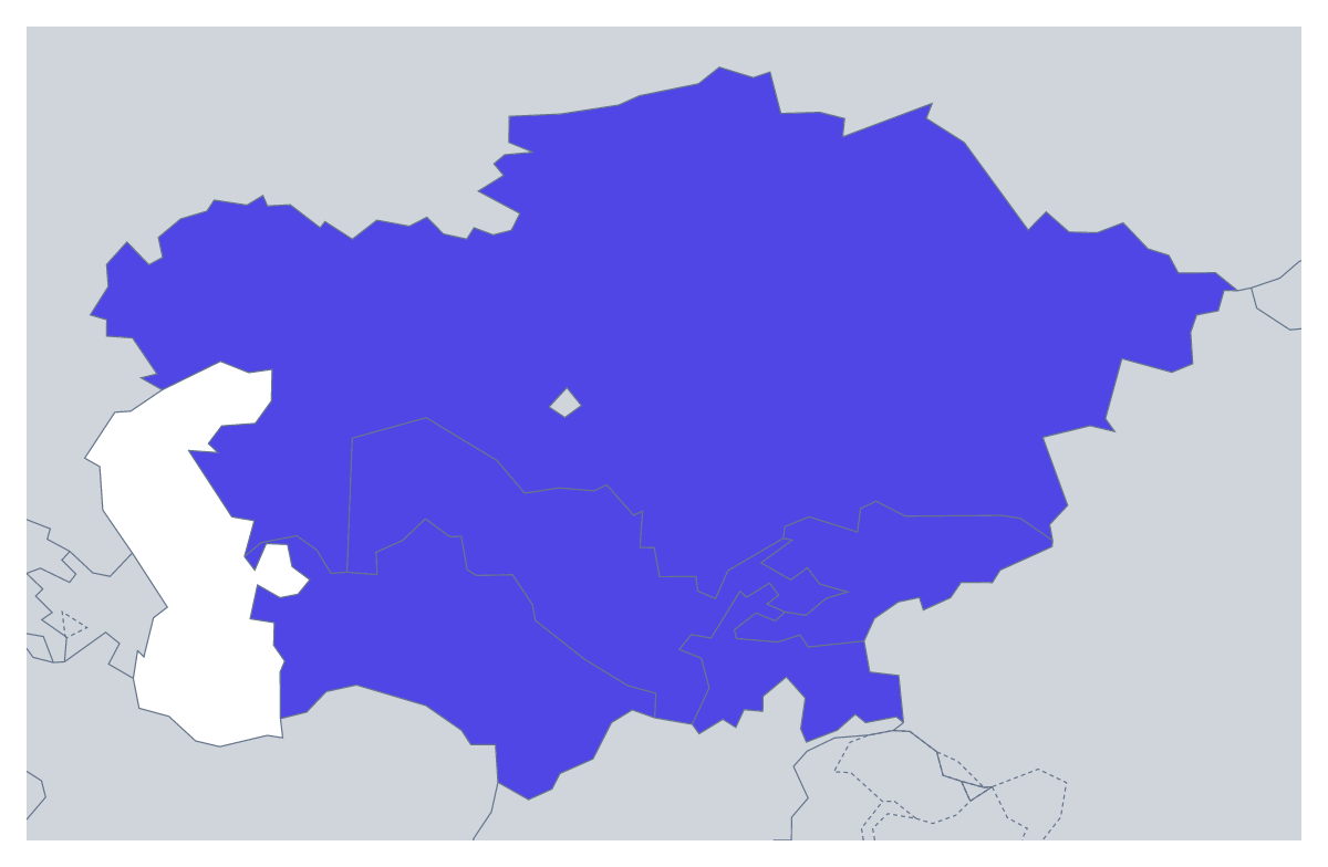
Printing a map of Central Asia
Few regions are as quick to put on a sheet as Central Asia, so this map often goes on a worksheet with other tasks, or on a card for a short test. You can print With country borders, which shows the five countries as separate shapes, or a Blank outline of the region. Both are PDFs for A4 or Letter, in colour or black and white, with no names on them.
Five names, five spellings
The names are the challenge here, not the shapes. Pupils fill in Kazakhstan, Kyrgyzstan, Tajikistan, Turkmenistan and Uzbekistan from the list further down the page, then swap sheets and mark each other's spelling letter by letter. A good starter is to hand out the sheet, keep the list to yourself and give three minutes. A scoring game keeps the class engaged: one point for each correct name, one more for each correct spelling.
Younger children can colour each country a different colour and write its name in the key at the side. A research task fits five pupils nicely: each takes a country, finds its capital in an atlas and writes it on the sheet.
Which sheet to print
With country borders is the sheet for naming and colouring. The Blank outline is for tracing or for pupils who draw the borders in from a reference map. Choose black and white for a class set. To shade countries first, use the bar on the map and Download your map. For the region in context, the printable map of Asia makes a good second sheet.
Printing tips
Print at 100% so the five countries come out at the same size on every copy, and laminate one for the wall.
How to do it in MapMaker
- Pick A4 or Letter, then Black and white for a class set.
- Choose With country borders for the five countries, or Blank outline for the region alone.
- Print the PDF at 100% so every copy has the same proportions.
- To colour countries first, pick a colour in the bar on the map, click them and choose Download your map.
- Choose Customise before printing for names, a title or A3 paper.
The 5 members on the map
A key for labelling the map by hand.
- Kazakhstan
- Kyrgyzstan
- Tajikistan
- Turkmenistan
- Uzbekistan
Facts about Central Asia
5 members are on the map. The members are Kazakhstan, Kyrgyzstan, Tajikistan, Turkmenistan and Uzbekistan.
Maps of places in Central Asia
Questions people ask
Which countries are on the printable map of Central Asia?
Five: Kazakhstan, Kyrgyzstan, Tajikistan, Turkmenistan and Uzbekistan. The list further down this page names each one, so it works as the answer key for a labelling sheet.
Is the printable map of Central Asia free?
Yes. Both versions are free to download and print on A4 or Letter, in colour or black and white, with no sign-up.
Which version is best for a spelling test?
With country borders. Each of the five countries has its own shape to name, and the list on the page gives the spellings to mark against. The blank outline leaves the borders out.
Do the PDFs show the names of the countries?
No. Names are left off so pupils write them in. To print a copy with names, choose Customise before printing, show the names in the editor and download a PDF from there.