Printable map of French departments
Free PDFs, ready for A4 or Letter. Print in colour or black and white.
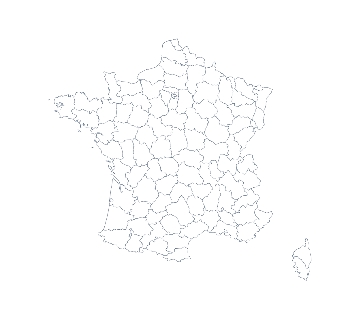
Printing a map of French departments
Teachers print this map for a department-by-department exercise: a revision sheet, a quiz round or a display where each group owns a few shapes. The version with regions draws all 101 departments with no names, and the blank outline gives the shape of the country alone. Both come as PDFs for A4 or Letter, in colour or black and white.
A sheet per pair
With 101 departments, the sheet is too full to label in one go, so split the work. Give each pair six departments to find on the sheet using the list further down this page, colour them and write the names in. Dordogne, Finistère, Vosges, Landes, Var and Nord make an easy first batch. Collect the sheets and lay them side by side to see how much of the country the class has covered; the gaps show what is left.
Younger children and home use
For younger children, print the blank outline and ask them to mark Paris, Lyon, Marseille, Lille and Nice with a dot and write each name next to it. Families can use a colour copy as a trip sheet, colouring a department when they have been there.
Which sheet, which ink
Choose With regions for any task about departments, and Blank outline for a single big shape to colour. Black and white at 100% gives the sharpest lines for a class set; colour suits a single sheet. If small departments are hard to read on A4, choose Customise before printing and download an A3 PDF from the editor. For the country's own page, see the printable map of France.
How to do it in MapMaker
- Choose With regions to print the 101 departments, or Blank outline for the shape of the country.
- Pick A4 or Letter and Black and white for photocopying.
- Open the PDF and print it at 100%, so the departments line up with your key.
- Colour the departments you want pre-filled with the bar on the map, then choose Download your map.
- Choose Customise before printing for A3 or names.
The 101 departments on the map
A key for labelling the map by hand.
- Ain
- Aisne
- Allier
- Alpes-de-Haute-Provence
- Alpes-Maritimes
- Ardèche
- Ardennes
- Ariège
- Aube
- Aude
- Aveyron
- Bas-Rhin
- Bouches-du-Rhône
- Calvados
- Cantal
- Charente
- Charente-Maritime
- Cher
- Corrèze
- Corse-du-Sud
- Côte-d’Or
- Côtes-d'Armor
- Creuse
- Deux-Sèvres
- Dordogne
- Doubs
- Drôme
- Essonne
- Eure
- Eure-et-Loir
- Finistère
- French Guiana
- Gard
- Gers
- Gironde
- Guadeloupe
- Haut-Rhin
- Haute-Corse
- Haute-Garonne
- Haute-Loire
- Haute-Marne
- Haute-Saône
- Haute-Savoie
- Haute-Vienne
- Hautes-Alpes
- Hautes-Pyrénées
- Hauts-de-Seine
- Hérault
- Ille-et-Vilaine
- Indre
- Indre-et-Loire
- Isère
- Jura
- Landes
- Loir-et-Cher
- Loire
- Loire-Atlantique
- Loiret
- Lot
- Lot-et-Garonne
- Lozère
- Maine-et-Loire
- Manche
- Marne
- Martinique
- Mayenne
- Mayotte
- Meurthe-et-Moselle
- Meuse
- Morbihan
- Moselle
- Nièvre
- Nord
- Oise
- Orne
- Paris
- Pas-de-Calais
- Puy-de-Dôme
- Pyrénées-Atlantiques
- Pyrénées-Orientales
- Réunion
- Rhône
- Saône-et-Loire
- Sarthe
- Savoie
- Seine-et-Marne
- Seine-Maritime
- Seine-Saint-Denis
- Somme
- Tarn
- Tarn-et-Garonne
- Territoire de Belfort
- Val-d'Oise
- Val-de-Marne
- Var
- Vaucluse
- Vendée
- Vienne
- Vosges
- Yonne
- Yvelines
Facts about French departments
This map shows 101 departments in Western Europe. Together they have an area of about 636,000 km². The capital is Paris. The population is about 67 million (2019 estimate). The largest cities are Paris, Lyon, Marseille, Lille and Nice.
Questions people ask
How many departments does the printable map show?
The version with regions shows 101 departments, each drawn as its own shape. The list of departments further down this page names every one, so you can use it as an answer key.
Does the printable map show the names of the departments?
No, the PDFs carry no names, so pupils can write them in. For a copy with names, choose Customise before printing, select the departments and choose Show names, then download a PDF from the editor.
What is the difference between the blank outline and the version with departments?
The blank outline is the shape of the country with no lines inside it. The version with regions draws all 101 departments, with no names, ready for pupils to label from the list on this page.
Can I print it in black and white?
Yes. Choose Black and white before opening the PDF. The lines photocopy cleanly, which suits a class set, and colour you add with the bar on the map prints as different greys.