Printable map of Japanese prefectures
Free PDFs, ready for A4 or Letter. Print in colour or black and white.
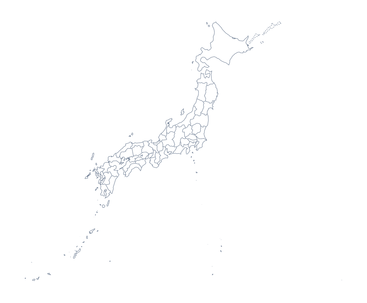
Printing a map of Japanese prefectures
A language teacher with a Japanese club, a geography class doing Asia and a family planning a trip all print this map for the same reason: 47 prefectures make a good sheet to write on. This page has the version with regions and a blank outline as PDFs for A4 or Letter, with no names on either.
For a quiz round
Number ten prefectures on the version with regions, and give pupils five minutes to write the names. Swap, mark against the list further down this page and count up. For a harder round, ask for the names of the prefectures you point to on a wall copy, with no list in sight.
For younger children
Give them the blank outline and a short job: put a dot on Tokyo, then dots for Ōsaka, Yokohama, Nagoya and Fukuoka, and write each name next to its dot. A colouring pencil per city makes it a matching game.
Trip planning at home
A family can print the version with regions and colour the prefectures they plan to visit, then write the dates beside them. The sheet goes into a travel folder and the blank outline can be used again on the next trip.
Picking the PDF
With regions is for labelling and quizzes; Blank outline is for placing cities or when only the shape matters. Choose Black and white for photocopies, and print at 100% when the sheet must line up with a key. If an edge gets cut, choose "fit to page" in your print settings.
For names, a title or A3 paper, choose Customise before printing. The printable map of Japan is the country's own sheet.
How to do it in MapMaker
- Choose With regions for the 47 prefectures, or Blank outline for the shape.
- Pick A4 or Letter, then Colour or Black and white.
- Open the PDF and print it at 100%.
- Colour the prefectures you need with the bar on the map, then choose Download your map to save a PDF with them.
- Choose Customise before printing for names, a title or an A3 sheet.
The 47 prefectures on the map
A key for labelling the map by hand.
- Aichi Prefecture
- Akita Prefecture
- Aomori Prefecture
- Chiba Prefecture
- Ehime Prefecture
- Fukui Prefecture
- Fukuoka Prefecture
- Fukushima Prefecture
- Gifu Prefecture
- Gunma Prefecture
- Hiroshima Prefecture
- Hokkaidō
- Hyōgo Prefecture
- Ibaraki Prefecture
- Ishikawa Prefecture
- Iwate Prefecture
- Kagawa Prefecture
- Kagoshima Prefecture
- Kanagawa Prefecture
- Kōchi Prefecture
- Kumamoto Prefecture
- Kyōto Prefecture
- Mie Prefecture
- Miyagi Prefecture
- Miyazaki Prefecture
- Nagano Prefecture
- Nagasaki Prefecture
- Nara Prefecture
- Niigata Prefecture
- Ōita Prefecture
- Okayama Prefecture
- Okinawa Prefecture
- Ōsaka Prefecture
- Saga Prefecture
- Saitama Prefecture
- Shiga Prefecture
- Shimane Prefecture
- Shizuoka Prefecture
- Tochigi Prefecture
- Tokushima Prefecture
- Tokyo
- Tottori Prefecture
- Toyama Prefecture
- Wakayama Prefecture
- Yamagata Prefecture
- Yamaguchi Prefecture
- Yamanashi Prefecture
Facts about Japanese prefectures
This map shows 47 prefectures in Eastern Asia. Together they have an area of about 373,000 km². The capital is Tokyo. The population is about 130 million (2019 estimate). The largest cities are Tokyo, Ōsaka, Yokohama, Nagoya and Fukuoka.
Questions people ask
How many prefectures does the printable map show?
The With regions PDF shows all 47 prefectures. The list further down this page names each one, so it is a ready key for checking a labelling sheet or a quiz.
Does the map show the names of the prefectures?
No. The PDFs are drawn without names so pupils can write them in. For a sheet with names, choose Customise before printing, select the prefectures, choose Show names and download a PDF.
Which cities can I mark on it?
Tokyo, Ōsaka, Yokohama, Nagoya and Fukuoka are the five largest cities in the map's data. Print the blank outline and ask pupils to mark them with dots, or add pins in the editor first.
Can I print it in black and white?
Yes. Choose Black and white before opening the PDF. It prints cleanly for a class set, and any prefectures coloured on the page print as different greys.