Printable map of Mexican states
Free PDFs, ready for A4 or Letter. Print in colour or black and white.
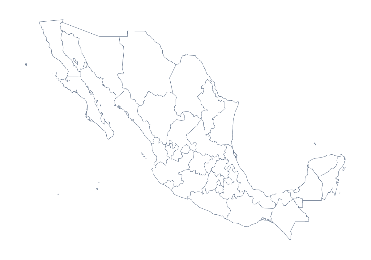
Printing a map of Mexican states
A quiz is the quickest use of a printable map of Mexican states: hand out the sheet, number some states and ask for the names. There are two PDFs. With regions shows the 31 states and Mexico City as separate shapes, and Blank outline is the shape of the country alone. Both are free, in A4 or Letter, and neither has names printed on it.
Quizzes and colouring
For a timed round, give pupils five minutes to write in Jalisco, Chiapas, Sonora, Yucatán and Veracruz and as many more as they can, then check against the list of states further down this page. Younger children can colour Mexico City in a bright colour, then mark Guadalajara, Monterrey and Puebla with a dot each.
A sheet per group works for a project: each group colours its states and labels them, and the sheets join into one display. For a lesson on the neighbours, ask pupils to write Belize, Guatemala and the United States of America beside the edges of the sheet where they lie, using an atlas. Pupils who finish first can pick a state they have not met, such as Tlaxcala or Colima, and find its name in the list.
Paper, ink and scale
Choose With regions whenever the states matter, and Blank outline when pupils will draw them in. Black and white copies photocopy well for a class set, and colour makes a better single sheet for a wall. Print at 100% if you want copies to match, or fit to page when a margin cuts the edges. The printable map of Mexico is the country on its own.
How to do it in MapMaker
- Pick A4 or Letter, then Colour for a wall sheet or Black and white for photocopies.
- Choose With regions for the 31 states and Mexico City, or Blank outline for the country alone.
- Open the PDF, print it and number the states you want named.
- Click states in the bar on the map to colour a quiz sheet your way, then choose Download your map.
- Choose Customise before printing for names, a title or a pin for a city.
The 31 states and Mexico City on the map
A key for labelling the map by hand.
- Aguascalientes
- Baja California
- Baja California Sur
- Campeche
- Chiapas
- Chihuahua
- Coahuila
- Colima
- Durango
- Guanajuato
- Guerrero
- Hidalgo
- Jalisco
- Mexico
- Michoacán
- Morelos
- Nayarit
- Nuevo León
- Oaxaca
- Puebla
- Querétaro
- Quintana Roo
- San Luis Potosí
- Sinaloa
- Sonora
- State of Mexico
- Tabasco
- Tamaulipas
- Tlaxcala
- Veracruz
- Yucatán
- Zacatecas
Facts about Mexican states
This map shows 31 states and Mexico City in Central America. Together they have an area of about 1,960,000 km². The capital is Mexico City. The population is about 130 million (2019 estimate). The largest cities are Mexico City, Guadalajara, Monterrey, Puebla and Tijuana.
Questions people ask
How many states does the printable map of Mexican states show?
The version with regions shows 31 states and Mexico City, each drawn as its own shape. The list further down this page names them, so you can use it to mark a quiz.
Are the names printed on the map?
No. The PDFs carry no names, so pupils can write them in. To print a copy with names or a title, choose Customise before printing and download a PDF from the editor.
Which version should I print for a labelling worksheet?
Print With regions. Every state and Mexico City is its own shape, so pupils have something to label, and the list on this page is the key. Blank outline is for pupils who draw the lines themselves.
Can I print it in black and white?
Yes. Choose Black and white before opening the PDF. The lines photocopy cleanly, and states you coloured with the bar on the map print as different greys.