Printable map of Spanish provinces
Free PDFs, ready for A4 or Letter. Print in colour or black and white.
Printing a map of Spanish provinces
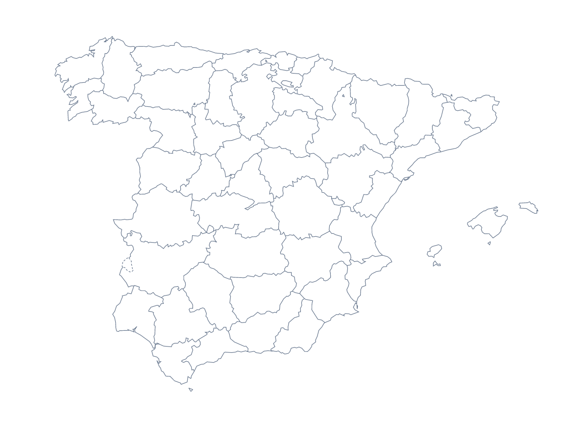
A Spanish teacher printing a map of the provinces usually wants one thing: a sheet pupils can write on. This page has two PDFs, the blank outline and a version with regions that draws 50 provinces and the autonomous cities of Ceuta and Melilla. Neither carries names, so the sheet is a task rather than an answer.
Sheets for the Spanish classroom
Start younger learners with the blank outline and three cities. Ask them to put a dot on Madrid, Barcelona and Seville and write each name beside its dot, then colour a province of their choice and say its name aloud.
For older pupils, use the version with regions and the list of provinces further down this page. Set a ten-minute round in which they write in as many names as they can, then swap and mark against the list. Spelling counts: A Coruña, Araba / Álava and Santa Cruz de Tenerife are good tests for a Spanish-language lesson.
A department can hand each group a handful of provinces to colour and label. Stick the sheets together on the wall and the class has made its own wall map.
Choosing the PDF
Pick With regions for labelling, quizzes and colouring by a rule, and Blank outline when the lesson is about the overall shape or the pupils will draw the lines themselves. If the key on this page needs to match the sheet, print at 100%; choose "fit to page" when the sheet should fill the paper. Pick A4 or Letter, and Black and white for photocopying.
To print provinces coloured to a rule you set, colour them with the bar on the map first. The editable map of the Spanish provinces adds names, a title and A3 paper.
How to do it in MapMaker
- Choose With regions to print the provinces, or Blank outline for the shape of Spain on its own.
- Pick A4 or Letter, then Black and white for a photocopied class set.
- Open the PDF and print at 100%, or "fit to page" if your printer trims the edges.
- Colour the provinces your lesson needs with the bar on the map; Download your map then saves a PDF with those colours.
- Choose Customise before printing for names, a title or an A3 sheet for the wall.
The 50 provinces and the autonomous cities of Ceuta and Melilla on the map
A key for labelling the map by hand.
- A Coruña
- Albacete
- Alicante
- Almería
- Araba / Álava
- Asturias
- Ávila
- Badajoz
- Balearic Islands
- Barcelona
- Biscay
- Burgos
- Cáceres
- Cádiz
- Cantabria
- Castellón
- Ceuta
- Ciudad Real
- Community of Madrid
- Córdoba
- Cuenca
- Gipuzkoa
- Girona
- Granada
- Guadalajara
- Huelva
- Huesca
- Jaén
- La Rioja
- Las Palmas
- León
- Lleida
- Lugo
- Málaga
- Melilla
- Murcia
- Navarre
- Ourense
- Palencia
- Pontevedra
- Salamanca
- Santa Cruz de Tenerife
- Segovia
- Seville
- Soria
- Tarragona
- Teruel
- Toledo
- Valencia
- Valladolid
- Zamora
- Zaragoza
Facts about Spanish provinces
This map shows 50 provinces and the autonomous cities of Ceuta and Melilla in Southern Europe. Together they have an area of about 506,000 km². The capital is Madrid. The population is about 47 million (2019 estimate). The largest cities are Madrid, Barcelona, Seville, Bilbao and Valencia.
Questions people ask
How many provinces does the printable map show?
The With regions PDF shows 50 provinces and the autonomous cities of Ceuta and Melilla, each drawn as its own shape. The list on this page names them all, so it works as the answer key.
Does the printable map show the names of the provinces?
No. The PDFs carry no names, so pupils write them in from the list. For a copy with names, choose Customise before printing, select the provinces, choose Show names and download a PDF from the editor.
Can I mark Madrid and the other big cities on it?
Print the blank outline and mark them by hand: Madrid, Barcelona, Seville, Bilbao and Valencia make a good first set. For printed pins and labels, choose Customise before printing and add them in the editor.
Can I print it in black and white for a class set?
Yes. Choose Black and white before you open the PDF. Lines stay sharp, and any provinces you colour with the bar on the map print as different greys, so pupils can still tell them apart.