Printable map of Western Europe
Free PDFs, ready for A4 or Letter. Print in colour or black and white.
Printing a map of Western Europe
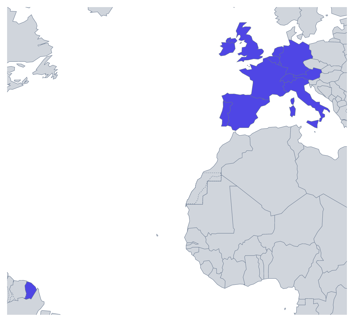
A printable map of Western Europe often goes with a unit on Europe, a languages lesson or a revision sheet before a test; parents and tutors print one for homework or a project. There are two versions: With country borders, which draws the 17 countries this map counts as Western Europe, and a Blank outline of the region without the lines between them. Both are PDFs for A4 or Letter, in colour or black and white, with no names printed.
Lessons on the region
Older pupils can label all 17 countries from the list further down this page, which doubles as an answer key. A shorter test works too: number eight of them on a black-and-white copy, perhaps Ireland, Portugal, Switzerland, Austria, Belgium, Luxembourg, Liechtenstein and Andorra, and ask for the names.
A languages class can shade the countries where the language they are learning is spoken, using their textbook as the guide, and add a key. For a school exchange or a trip, pupils can mark the countries the group will travel through and draw the route between them in pencil.
Younger children can colour each country in a different colour and write its name in a key at the side. A second round can be a search: once the rest are coloured, ask who can find Monaco, San Marino and Vatican City on the sheet.
Which version to print
Print With country borders for labelling, quizzes and colouring by a rule, since every country has a shape of its own. Print the Blank outline when pupils will draw the borders themselves. Choose black and white for a class set to photocopy and colour for a single copy. To shade a few countries before printing, colour them with the bar on the map and choose Download your map; for names or a title, choose Customise before printing. For the whole continent, the printable map of Europe has the same two versions.
Printing tips
For a wall display, the A3 PDF from Customise before printing gives the 17 countries more room than A4. On a home printer, keep to 100% and choose "fit to page" only if the edges go missing.
How to do it in MapMaker
- Pick A4 or Letter, and Black and white if you will photocopy a class set.
- Choose With country borders for the 17 countries, or Blank outline for the shape of the region.
- Print the PDF at 100% so every copy comes out the same size.
- Shade the countries a lesson needs with the bar on the map, then choose Download your map.
- Choose Customise before printing for names, a title or an A3 sheet.
The 17 members on the map
A key for labelling the map by hand.
- Andorra
- Austria
- Belgium
- France
- Germany
- Ireland
- Italy
- Liechtenstein
- Luxembourg
- Monaco
- Netherlands
- Portugal
- San Marino
- Spain
- Switzerland
- United Kingdom
- Vatican City
Facts about Western Europe
This map shows the countries usually counted as Western Europe, from the UK and Ireland to Italy. 17 members are on the map.
Maps of places in Western Europe
Questions people ask
Which countries are on the printable map of Western Europe?
The 17 countries this map counts as Western Europe, from Andorra to Vatican City in the list further down this page. That list names every one of them, so it works as the answer key for a labelling sheet.
What is the difference between the blank outline and the version with country borders?
The blank outline shows the land of the region without the lines between countries. The version with country borders adds them, so each of the 17 countries has its own shape to label or colour. Neither has names printed on it.
Can I print the map of Western Europe on A3?
The PDFs on this page are for A4 and Letter. For an A3 sheet for a wall display, choose Customise before printing and download an A3 PDF from the editor.
Is this printable map of Western Europe free?
Yes. Both versions are free to download and print, on A4 or Letter, in colour or black and white, with no account to make and nothing to sign up for.