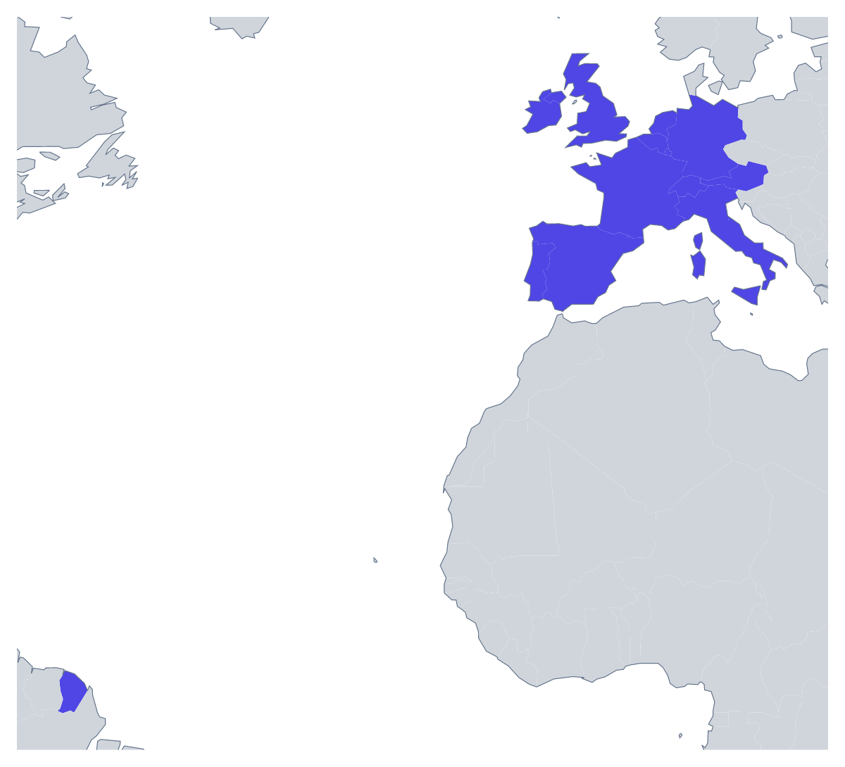
Blank map of Western Europe
The outline, free as a PNG, SVG or PDF. Label it, colour it in or drop it into a slide.
Using a blank map of Western Europe
The outline of Western Europe turns up on the title slide of a European sales review, the cover of a study-abroad brochure, the poster for a European evening at school and the header of a newsletter. With borders splits the region into its 17 countries; Outline only keeps the land as one shape. Either comes as a PNG with a transparent background, an SVG or a PDF.
On slides and in documents
For a European team's deck, place the transparent PNG on the title slide and list the offices or markets beside it, or set it small in the corner of each slide of a quarterly review. In a report or a brochure, the outline makes a quiet header above a section on the region; because the background is transparent, it sits on a coloured band as easily as on white paper.
For designers
The SVG opens in Illustrator, Inkscape or Figma at any size, so it suits work that goes well beyond a screen. Set the borders in a brand colour for an infographic, fill a handful of countries for a campaign graphic, or simplify the outline into a single line for a tote bag or a T-shirt for a school trip. Because each country is its own shape in With borders, a designer can recolour or drop them one by one.
Silhouette or borders
Outline only works best when the map is small or decorative: an icon, a stamp, a pale pattern behind a slide title. With borders is the political blank map of Western Europe, the one to pick whenever the countries need to be told apart. The PNG is the file for slides and documents, the SVG for design work, and the PDF for a copy printed as it is on A4 or Letter. For class sets in black and white, see the printable map of Western Europe; for the whole continent, the blank map of Europe.
How to do it in MapMaker
- Pick Outline only for the region as one shape, or With borders for its 17 countries.
- Download the PNG for a deck or a brochure, or the SVG for a design tool.
- Use PDF, A4 or PDF, Letter when the outline is going straight to the printer.
- Open Customise this map to add names, colours or a title, then download the result from the editor.
The 17 members on the map
A key for labelling the map by hand.
- Andorra
- Austria
- Belgium
- France
- Germany
- Ireland
- Italy
- Liechtenstein
- Luxembourg
- Monaco
- Netherlands
- Portugal
- San Marino
- Spain
- Switzerland
- United Kingdom
- Vatican City
Facts about Western Europe
This map shows the countries usually counted as Western Europe, from the UK and Ireland to Italy. 17 members are on the map.
Maps of places in Western Europe
Questions people ask
Is there a political blank map of Western Europe?
Yes: the With borders version. It draws the borders between the 17 countries this map counts as Western Europe, with no names, so each country is a separate shape you can colour or style.
Does the blank map show the names of the countries?
No. A blank map has no names on it. The list of countries further down this page names all 17, and Customise this map opens the outline in the editor if you want the names shown on the map.
Can I open the SVG in Illustrator, Inkscape or Figma?
Yes. The SVG is a vector file, so the outline of Western Europe and its country borders stay sharp at any size, and each line can be recoloured or given a new weight in a design tool.