Blank map of Honduras
The outline, free as a PNG, SVG or PDF. Label it, colour it in or drop it into a slide.
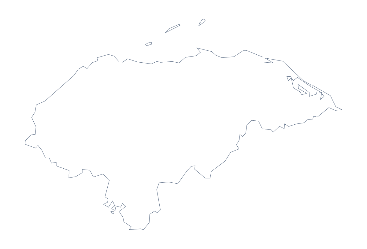
Using a blank map of Honduras
For a quiz in your own slides, a poster or a design that needs the shape of Honduras, a blank map is the starting file. Outline only is the country with nothing inside, and With borders adds its 18 administrative areas. Each version comes as a PNG, an SVG or a PDF.
Shape-recognition rounds
A "which shape is this?" starter needs only Outline only. Put the PNG on a slide and ask the class to name the country. On the next slide, use the With borders PNG, colour one area in your slide software and ask which it is. Colón, Lempira, Copán and Valle make a good set of four to try.
For a longer session, keep the With borders PNG as the background of every slide in the section and change which area is coloured from one slide to the next. The list of areas further down this page gives the names in order.
Slides and a poster
On a slide, the transparent PNG sits on any theme colour. Put a title to one side and a few figures below. For a poster, take the SVG into Illustrator, Inkscape or Figma and recolour the areas, then give the Bay Islands a colour of their own so they stand out. The same file scales to a banner without blurring.
Which version, which file
The political blank map of Honduras is the With borders version, with area lines and no names. Outline only is better for a silhouette or younger pupils. PNG is for worksheets and slides; SVG for design tools; PDF for A4 or Letter. For names, a title or pins, use Customise this map. The editable map of Honduras has a colour bar if you want areas coloured before you download.
How to do it in MapMaker
- Choose Outline only for a shape round, or With borders for the 18 areas.
- Pick PNG for slides, SVG for a poster or design tool, or PDF, A4 or PDF, Letter.
- Place the file on your slide or page and resize it from a corner to keep the proportions.
- Colour one area per slide in your slide software and take the names from the list on this page.
- Choose Customise this map when you need names, colours or a title.
The 18 administrative areas on the map
A key for labelling the map by hand.
- Atlántida
- Bay Islands
- Choluteca
- Colón
- Comayagua
- Copán
- Cortés
- El Paraíso
- Francisco Morazán
- Gracias a Dios
- Intibucá
- La Paz
- Lempira
- Ocotepeque
- Olancho
- Santa Bárbara
- Valle
- Yoro
Facts about Honduras
Honduras is in Central America. The capital is Tegucigalpa. The population is about 9.7 million (2019 estimate). Honduras has an area of about 113,000 km². The largest cities are Tegucigalpa, San Pedro Sula, La Ceiba, Choluteca and Comayagua. It borders El Salvador, Guatemala and Nicaragua. The map divides it into 18 administrative areas.
Maps of neighbouring places
Questions people ask
Is there a political blank map of Honduras?
Yes. With borders is the political blank map of Honduras: the outline with the lines of all 18 administrative areas, and no names. Outline only is the shape alone.
How many areas does the blank map show?
The With borders version shows 18 administrative areas, including the Bay Islands as an area of their own. The list further down this page names all of them.
Does the PNG have a transparent background?
Yes. The PNG has no background colour, so the outline of Honduras takes the colour of the slide or page you place it on.
Can I print the blank map?
Yes. Choose PDF, A4 or PDF, Letter and print it at 100%. For black and white or other print choices, the printable page of Honduras has them.