Printable map of the Balkans
Free PDFs, ready for A4 or Letter. Print in colour or black and white.
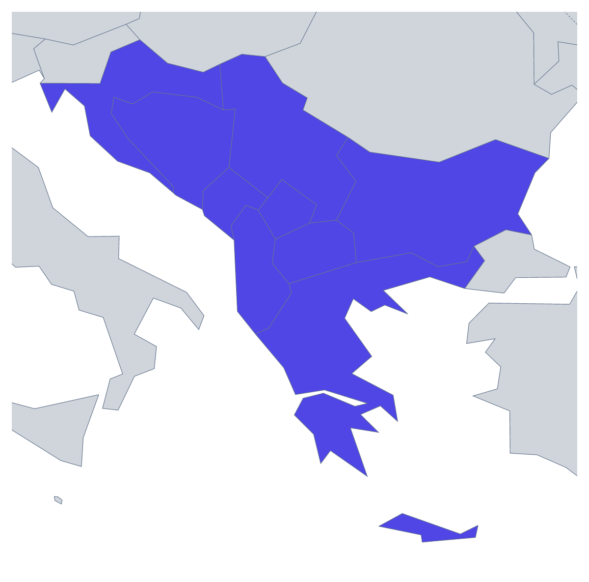
Printing a map of the Balkans
A printable map of the Balkans is often wanted for a geography lesson on the region, a history topic, a test on its countries or a project at home. There are two versions: With country borders, which draws the nine countries this map counts as the Balkans, and a Blank outline of the region without the lines between them. Both are PDFs for A4 or Letter, in colour or black and white, with no names printed.
Classroom ideas for the Balkans
Nine countries make a manageable labelling sheet. Older pupils can name them all from memory, then check against the list further down this page, which doubles as the answer key. For a timed starter, number five of them, such as Montenegro, North Macedonia, Bosnia and Herzegovina, Albania and Kosovo, and give the class three minutes.
Younger children can colour each country a different colour, copy the names into a key and add a compass rose. For a writing task, each pupil picks one country, colours it on the sheet and writes a postcard home as if from there, with the map stuck on the back.
To compare two regions, print the printable map of the Mediterranean as well. Pupils shade, on both sheets, the countries that appear on the two maps, and talk about why a country can belong to more than one region.
Which version to print
With country borders is the one for labelling, quizzes and colouring by a rule, since each country has its own shape. The Blank outline suits drawing the borders in. Black and white is the one to photocopy for a class; colour suits a single sheet for the wall. To shade some countries before you print, use the bar on the map, then Download your map. For names on the map, a title or A3, choose Customise before printing.
Printing tips
Print one black-and-white master first and check it before you photocopy a class set. A laminated copy on each table, marked with dry-wipe pens, serves several classes in a day.
How to do it in MapMaker
- Select A4 or Letter, then Colour or Black and white.
- Choose With country borders for the nine countries, or Blank outline for the region alone.
- Print the PDF at 100% so the outline keeps its proportions.
- To shade countries first, pick a colour in the bar on the map, click them and choose Download your map.
- Choose Customise before printing to add names, a title or an A3 sheet.
The 9 members on the map
A key for labelling the map by hand.
- Albania
- Bosnia and Herzegovina
- Bulgaria
- Croatia
- Greece
- Kosovo
- Montenegro
- North Macedonia
- Serbia
Facts about the Balkans
This map shows the countries usually counted as the Balkans; some definitions add others. 9 members are on the map. The members are Albania, Bosnia and Herzegovina, Bulgaria, Croatia, Greece, Kosovo, Montenegro, North Macedonia and Serbia.
Maps of places in the Balkans
Questions people ask
Which countries are on the printable map of the Balkans?
The nine countries this map counts as the Balkans: Albania, Bosnia and Herzegovina, Bulgaria, Croatia, Greece, Kosovo, Montenegro, North Macedonia and Serbia. The list further down this page names them, so it doubles as an answer key.
Which version should I print for a labelling worksheet?
The version with country borders, which gives each of the nine countries its own shape to name. The blank outline drops the lines between them, which suits a task where pupils draw the borders in from an atlas.
Is there an answer key for a quiz?
Yes. The list of countries further down this page names all nine shapes on the map. Number them on a blank copy, hand out the sheet and read the list out when pupils swap papers to mark.
Can I print the map of the Balkans on A3?
Not from this page, which has A4 and Letter. Choose Customise before printing and the editor downloads the same map as a PDF on A3, which suits a display board.