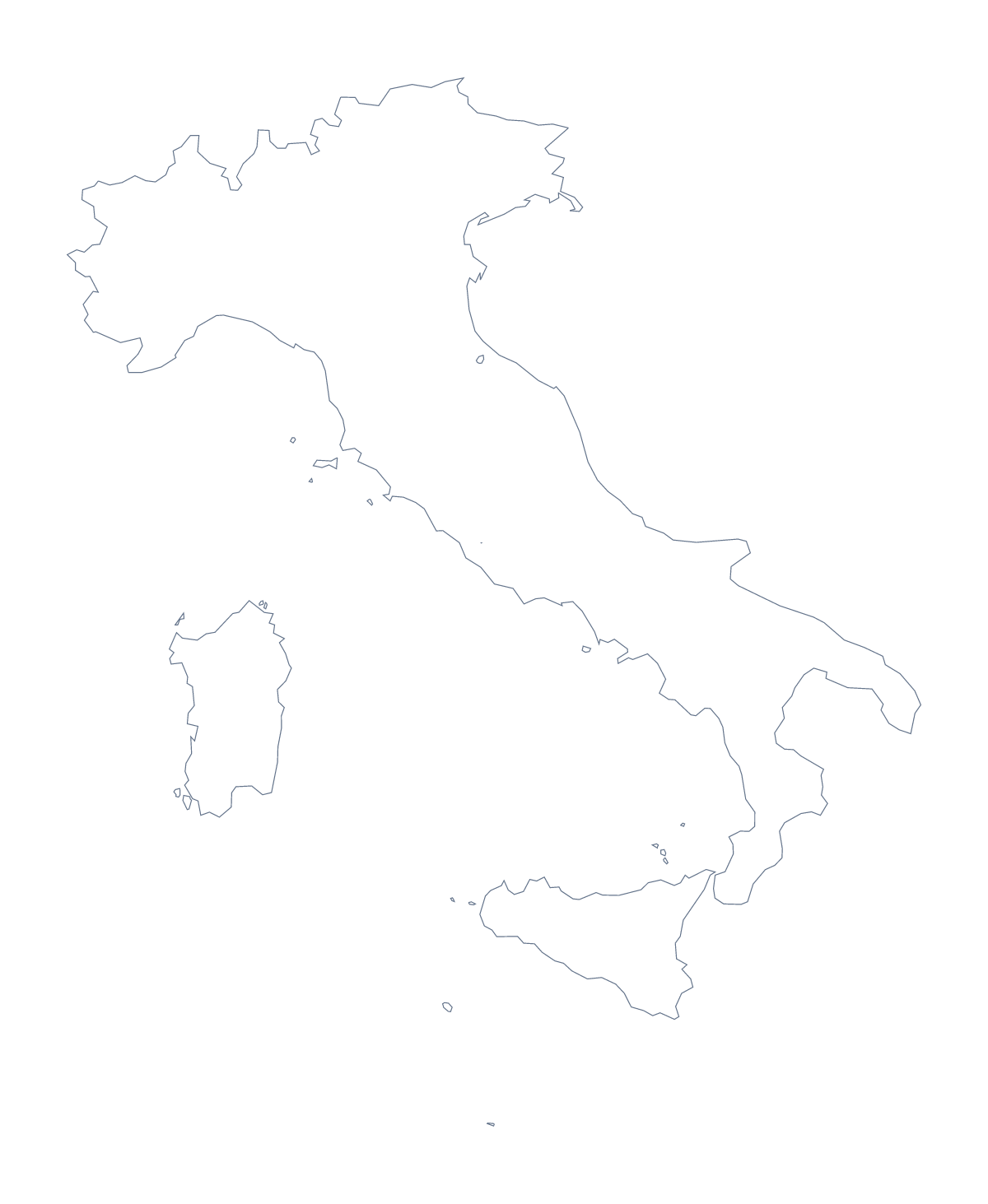
Blank map of Italy
The outline, free as a PNG, SVG or PDF. Label it, colour it in or drop it into a slide.
Using a blank map of Italy
A blank map of Italy is usually the base for something bigger: a poster, a slide, a worksheet, a piece of design. Outline only gives you the country with nothing inside it, and With borders adds its 110 administrative areas. Each version comes as a PNG on a transparent background, an SVG or a PDF for A4 or Letter.
Scaling up the detail
With 110 areas, the With borders version has a great many small shapes, so take the SVG or a PDF when it will go on a poster or a display board; both are vector files and keep every line sharp. In a design tool you can thicken the lines, recolour areas in your brand palette or trace the outline. On a slide the PNG is enough, and its transparent background takes the slide's own colour.
A quiz from a dense map
Copy the With borders PNG onto a run of slides and fill one area on each, for instance Bari, Palermo, Naples or Turin, then ask the class which it is. The list further down this page is the answer sheet. A gentler task for younger children uses Outline only: they colour the whole shape in one colour and cut it out for a display.
The political version, and what else
The political blank map of Italy is the With borders version. For names, pins or colours, choose Customise this map to open the same outline in the editor. To start from the provinces, use the blank map of the Italian provinces; for print choices, the printable map of Italy.
How to do it in MapMaker
- Choose With borders for the 110 administrative areas, or Outline only for the shape of Italy alone.
- Pick the SVG or a PDF for anything that will be enlarged, and the PNG for slides and documents.
- Place the file on your page and resize it from a corner.
- Mark a guessing quiz against the list of areas on this page.
The 110 administrative areas on the map
A key for labelling the map by hand.
- Agrigento
- Alessandria
- Ancona
- Aosta
- Arezzo
- Ascoli Piceno
- Asti
- Avellino
- Bari
- Barletta-Andria-Trani
- Belluno
- Benevento
- Bergamo
- Biella
- Bologna
- Brescia
- Brindisi
- Cagliari
- Caltanissetta
- Campobasso
- Carbonia-Iglesias
- Caserta
- Catania
- Catanzaro
- Chieti
- Como
- Cosenza
- Cremona
- Crotone
- Cuneo
- Enna
- Fermo
- Ferrara
- Florence
- Foggia
- Forlì-Cesena
- Frosinone
- Gorizia
- Grosseto
- Imperia
- Isernia
- L'Aquila
- La Spezia
- Latina
- Lecce
- Lecco
- Liguria
- Livorno
- Lodi
- Lucca
- Macerata
- Mantua
- Massa-Carrara
- Matera
- Medio Campidano
- Messina
- Milan
- Modena
- Monza and Brianza
- Naples
- Novara
- Nuoro
- Ogliastra
- Olbia-Tempio
- Oristano
- Padua
- Palermo
- Parma
- Pavia
- Perugia
- Pesaro and Urbino
- Pescara
- Piacenza
- Pisa
- Pistoia
- Pordenone
- Potenza
- Prato
- Ragusa
- Ravenna
- Reggio Calabria
- Reggio Emilia
- Rieti
- Rimini
- Rome
- Rovigo
- Salerno
- Sassari
- Savona
- Siena
- Sondrio
- Syracuse
- Taranto
- Teramo
- Terni
- Trapani
- Trentino
- Trentino-South Tyrol
- Treviso
- Trieste
- Turin
- Udine
- Varese
- Venice
- Verbano-Cusio-Ossola
- Vercelli
- Verona
- Vibo Valentia
- Vicenza
- Viterbo
Facts about Italy
Italy is in Southern Europe. The capital is Rome. The population is about 60 million (2019 estimate). Italy has an area of about 301,000 km². The largest cities are Rome, Milan, Naples, Turin and Florence. It borders Austria, France, San Marino, Slovenia, Switzerland and Vatican City. The map divides it into 110 administrative areas.
Maps of neighbouring places
Questions people ask
Can I make the outline of Italy bigger without it going blurry?
Yes. Take the SVG or a PDF: both are vector files, so the 110 administrative areas stay crisp when you scale the map up for a poster or a display board.
Is there a political blank map of Italy?
Yes, the With borders version. It draws the 110 administrative areas with no names, ready for labelling by hand or colouring in a design tool.
Is there a blank map of the Italian provinces on its own?
Yes. The blank map of the Italian provinces has its own page and leads with the provinces. This page leads with the country, so Outline only is the shape of Italy alone.
Does the blank map show the names of the areas?
No, nothing on it is named. The list further down this page names every area, so it works as a key for checking labels.