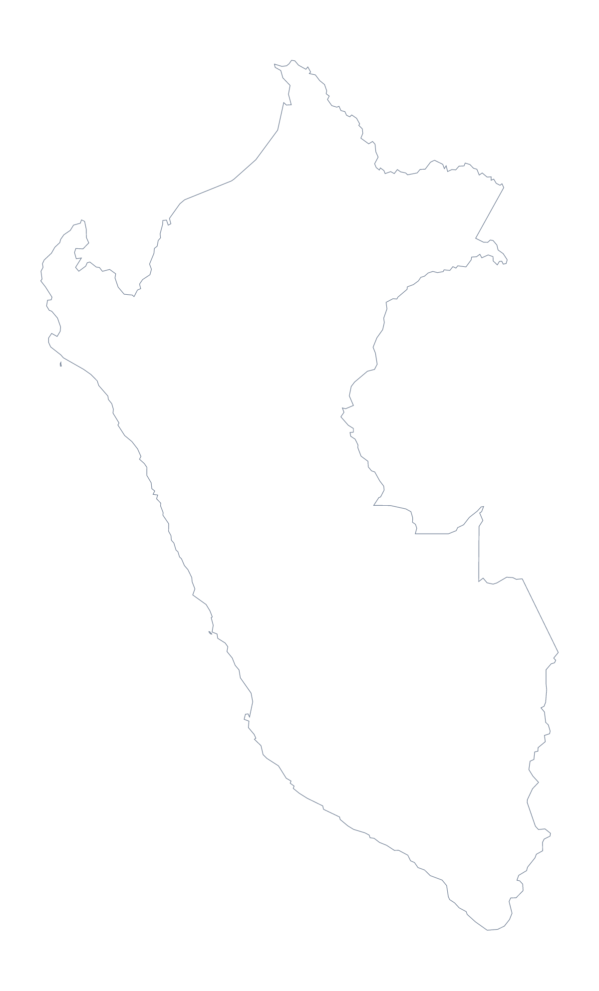
Blank map of Peru
The outline, free as a PNG, SVG or PDF. Label it, colour it in or drop it into a slide.
Using a blank map of Peru
Peru is usually wanted as a shape to build on: a header for a proposal, a map on a revision slide, a poster in the colours of a campaign. This page gives you that shape as a file. Outline only is Peru with nothing inside it, and With borders draws its 26 administrative areas. Each version comes as a PNG, an SVG or a PDF.
In a slide or a design tool
Drop the PNG of Outline only onto a title slide and the transparent background lets your theme colour show around the country. A heavier line, a gradient or a drop shadow added in Illustrator, Inkscape or Figma turns the SVG into a cover graphic. A trainer building a regional briefing can lay the With borders SVG under a table, then colour the 26 administrative areas to match the headings.
In a document
The political blank map of Peru is the With borders version, and it suits a page that needs the areas as shapes without the names: a report section, a revision handout, a campaign leaflet. Place the PNG in your document and write your own captions, taking the spellings from the list of areas further down this page. Outline only is the version for a plain backdrop.
Picking a file
PNG suits documents and slides. SVG is the one to scale up, since the lines stay sharp on any poster. PDF is for printing on A4 or Letter at 100%. For colour or black-and-white print choices, the printable map of Peru is the better page. To add names, a title or colour, choose Customise this map, or open the editable map of Peru.
How to do it in MapMaker
- Choose With borders for the 26 administrative areas, or Outline only for the plain shape of Peru.
- Download SVG if the map will go into a design tool, or PNG if it is headed for a worksheet or a slide.
- Place the PNG on your page and drag from a corner to resize it, keeping the proportions.
- Take the spellings for your captions from the list of administrative areas below the steps.
- Choose Customise this map if you need names, colours or a title, and download from the editor.
The 26 administrative areas on the map
A key for labelling the map by hand.
- Amazonas
- Áncash
- Apurímac
- Arequipa
- Ayacucho
- Cajamarca
- Callao
- Cusco Departament
- Huancavelica
- Huanuco
- Ica
- Junín
- La Libertad
- Lambayeque
- Lima
- Lima
- Loreto
- Madre de Dios
- Moquegua
- Pasco
- Piura
- Puno
- San Martín
- Tacna
- Tumbes
- Ucayali
Facts about Peru
Peru is in South America. The capital is Lima. The population is about 33 million (2019 estimate). Peru has an area of about 1,300,000 km². The largest cities are Lima, Callao, Arequipa, Trujillo and Chiclayo. It borders Bolivia, Brazil, Chile, Colombia and Ecuador. The map divides it into 26 administrative areas.
Maps of neighbouring places
Questions people ask
Is there a political blank map of Peru?
Yes. It is the With borders version, which draws the lines between the 26 administrative areas and carries no names. Outline only gives the plain shape of Peru for a silhouette or a cover.
Does the PNG have a transparent background?
Yes. Everything around Peru is see-through, so the shape takes the colour of the slide, box or poster you place it on, with no white rectangle behind it.
Can I make the outline of Peru bigger without it going blurry?
Yes, with the SVG. It is a vector file, so the outline and the area lines stay sharp at any size, from a worksheet box to a wall poster. The PNG is for ordinary sizes.
Can I show the countries around Peru?
Not on this page, which gives the outline only. Choose Customise this map to open Peru in the editor, where Neighbours draws the surrounding countries in grey before you download.