Blank map of Senegal
The outline, free as a PNG, SVG or PDF. Label it, colour it in or drop it into a slide.
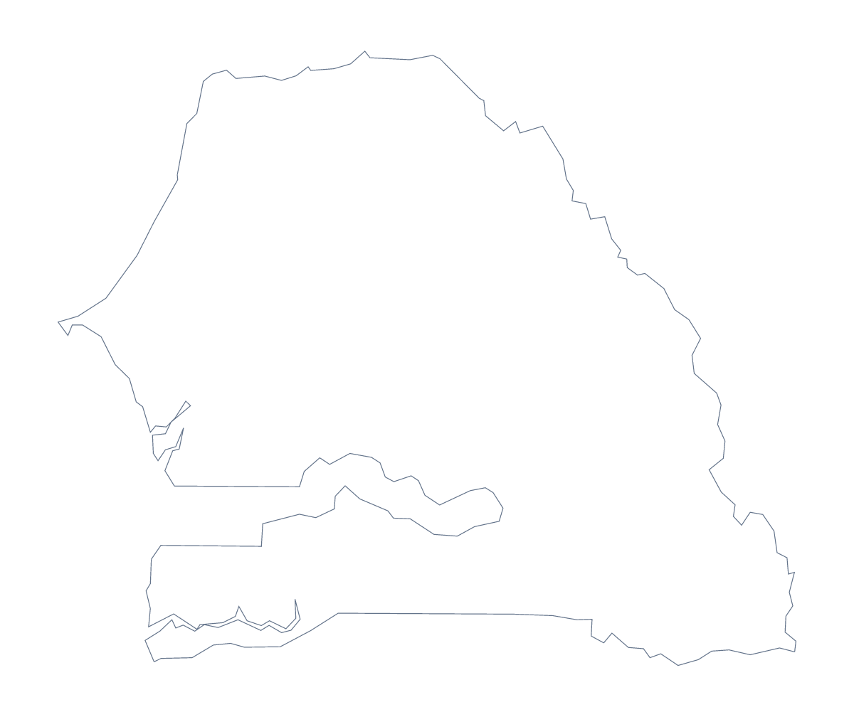
Using a blank map of Senegal
People who download a blank map of Senegal are often building an infographic or a handout of their own and want the base to be right. This page gives you that base in two versions, Outline only and With borders, each as a PNG on a transparent background, an SVG and a PDF. The second draws the 14 administrative areas, with no names on any of them.
An infographic base
In a design tool, open the SVG and treat each of the 14 areas as an object. Fill Dakar with the colour of your brand and keep the others pale, or shade a group of areas in a second colour for a regional split. Add a pin for Thiès or Kaolack and a call-out box with a figure. The file scales cleanly, so the same artwork works on a one-page report and on a large poster.
If you are not using a design tool, place the PNG on a slide. The transparent background lets the slide's own colour through, and you can draw directly over Senegal.
On a unit sheet
With borders is the political blank map of Senegal. A teacher building a unit sheet can place it beside a table of the areas the unit covers, taking the spellings from the list further down this page. For a cover sheet, Outline only with the title across the top is enough.
Choosing the file
PNG for documents and slides, SVG for designers and enlarging, PDF for A4 or Letter. For printing choices such as black and white, use the printable map of Senegal.
If you need more than the outline
Customise this map opens the same outline in the editor for names, colours, pins or a title. For a map with data on it, the choropleth map of Senegal colours the areas from a spreadsheet.
How to do it in MapMaker
- Choose With borders for the 14 administrative areas, or Outline only for the shape alone.
- Download the SVG for a design tool, the PNG for a slide or the PDF for A4 or Letter.
- Colour areas or add call-outs in your own layout.
- For names, pins or a title on the map itself, choose Customise this map.
The 14 administrative areas on the map
A key for labelling the map by hand.
- Dakar
- Diourbel
- Fatick
- Kaffrine
- Kaolack
- Kédougou
- Kolda
- Louga
- Matam
- Saint-Louis
- Sédhiou
- Tambacounda
- Thiès
- Ziguinchor
Facts about Senegal
Senegal is in Western Africa. The capital is Dakar. The population is about 16 million (2019 estimate). Senegal has an area of about 197,000 km². The largest cities are Dakar, Thiès, Kaolack, Ziguinchor and Diourbel. It borders Gambia, Guinea, Guinea-Bissau, Mali and Mauritania. The map divides it into 14 administrative areas.
Maps of neighbouring places
Questions people ask
How many areas does the blank map of Senegal show?
The With borders version draws 14 administrative areas, from Dakar to Ziguinchor, without names. The list further down this page names every one, so it doubles as an answer key.
Is there a political blank map of Senegal?
Yes. It is the With borders version, which draws all 14 administrative areas with no names. Outline only is the shape without any inner lines.
Can I show the countries around Senegal?
Not on this page, which gives the outline only. Choose Customise this map to open it in the editor, where the Neighbours switch draws the countries around Senegal in grey.
Can I make the outline bigger without it going blurry?
Yes. The SVG and PDF are vector files, so Senegal stays sharp at any size. Scale the SVG up for a poster or a banner in your design tool.