Blank map of Serbia
The outline, free as a PNG, SVG or PDF. Label it, colour it in or drop it into a slide.
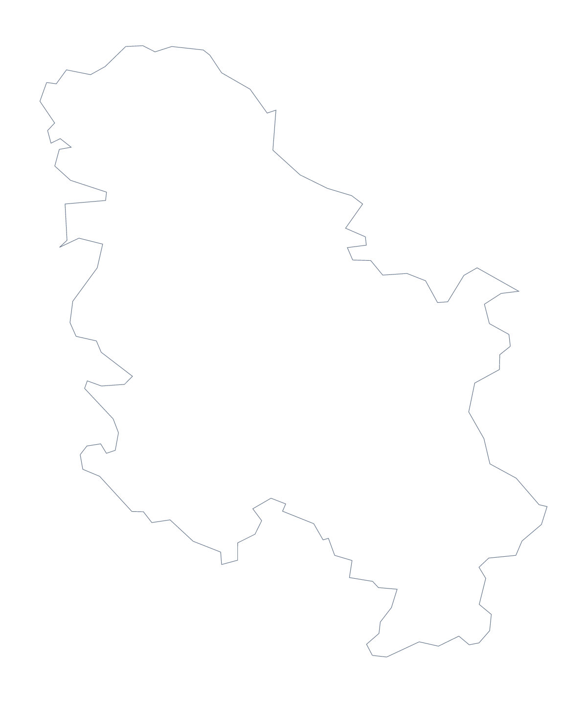
Using a blank map of Serbia
A blank map of Serbia is for putting the shape into work of your own: a worksheet for a geography or language class, a slide, a poster for a club or an event, a piece of craft. The two versions are Outline only, the shape alone, and With borders, which adds the lines of its administrative areas. Each is a PNG, an SVG and a PDF.
Picking a version and a file
Choose With borders when the areas matter: matching names to shapes, colouring by a key, marking a few areas for a project. Choose Outline only for a clean silhouette on a cover or a slide, or for younger children who would find the inner lines confusing. Then pick the file. The PNG goes into a word processor or a slide, and its transparent background takes the colour behind it. The SVG is for Illustrator, Inkscape or Figma, and for any size without blurring. The PDF prints the outline on A4 or Letter as it is.
Matching and colouring in your own worksheet
Place the PNG of With borders in a worksheet and put a word bank beside it: Srem, Mačva, Kolubara, Moravica and a few more from the list further down this page. Pupils draw a line from each name to its area, and the list doubles as the answer key.
For a personal map, pupils colour the areas they have visited or where family lives and make their own key in the margin, one colour per meaning. It works as a first-week activity in a new class, and the finished sheets make a display.
Posters and designs
The SVG can be restyled for a poster: a heavier outline, the areas filled in a club's colours, a town marked with a star you draw yourself. Traced at a large size, it becomes a stencil or the base of a hand-drawn map.
When the map needs names, pins or a title, Customise this map opens the same outline in the editor. For black and white or for colouring areas before printing, use the printable map of Serbia.
How to do it in MapMaker
- Decide on With borders for work on the areas or Outline only for a plain shape.
- Download the PNG for a word processor or a slide, or the SVG for a design tool.
- Add your own word bank or key around the outline, and check answers against the list on this page.
- Choose Customise this map for names, colours or a title, then download it from the editor.
The 25 administrative areas on the map
A key for labelling the map by hand.
- Belgrade
- Bor
- Braničevo
- Central Banat
- Jablanica
- Kolubara
- Mačva
- Moravica
- Nišava
- North Bačka
- North Banat
- Pčinja
- Pirot
- Podunavlje
- Pomoravski
- Rasina
- Raška
- South Bačka
- South Banat
- Srem
- Šumadija
- Toplica
- West Bačka
- Zaječar
- Zlatibor
Facts about Serbia
Serbia is in Southern Europe. The capital is Belgrade. The population is about 6.9 million (2019 estimate). The largest cities are Belgrade, Niš, Novi Sad, Kragujevac and Čačak. It borders Bosnia and Herzegovina, Bulgaria, Croatia, Hungary, Kosovo, Montenegro, North Macedonia and Romania. The map divides it into 25 administrative areas.
Maps of neighbouring places
Questions people ask
Does the blank map show the names of the administrative areas?
No. The outline and the lines between areas carry no names. The list of administrative areas further down this page gives each name, from Belgrade to Zlatibor, with the accents kept, so pupils can check their spelling.
Can I open the SVG in Illustrator, Inkscape or Figma?
Yes. The SVG of Serbia is a vector file, so it opens in those tools and stays sharp at any size. You can recolour the areas, thicken the outline or trace it as the base of a poster.
How is this different from the printable map of Serbia?
This page gives the outline as a file to put into your own worksheet, slide or design. The printable map of Serbia has ready-made PDFs in colour or black and white, and a bar for colouring areas before you print.
Can I show the countries around Serbia?
Not on these files, which draw Serbia alone. Choose Customise this map and switch on Neighbours in the editor's Place settings to add Hungary, Croatia, Bulgaria and the other countries around it.