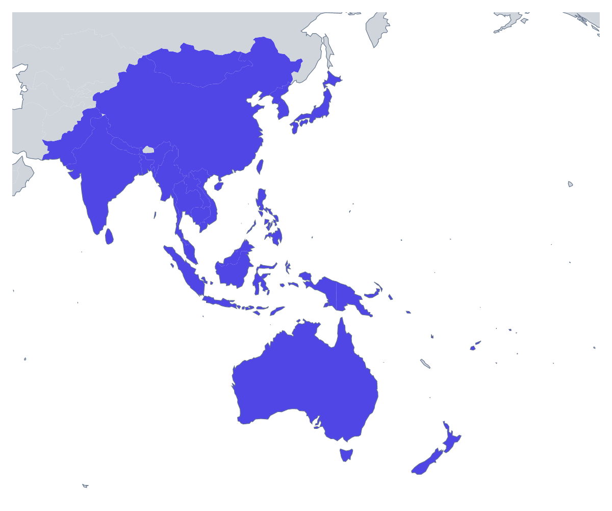
Blank map of Asia-Pacific
The outline, free as a PNG, SVG or PDF. Label it, colour it in or drop it into a slide.
Using a blank map of Asia-Pacific
A blank outline of Asia-Pacific is usually a starting point for something larger: the opening slide of a regional review, the backdrop of a conference stand, a cover for a market report, a handout for a geography unit. Choose Outline only for the land as one shape or With borders for the 36 countries, then the file: a PNG with a transparent background, an SVG or a PDF.
Behind a presentation
Drop the transparent PNG onto a slide in your brand colour and set the region's name in front of it. Because only the land is drawn, the shape works as a pale backdrop under a table of figures, or as a small corner mark on every slide of the review. In a handout, the same file sits at the top of a page as a regional header.
For designers
The SVG opens in Illustrator, Inkscape or Figma with the 36 countries as separate shapes. Fill the countries of one programme in a strong colour and leave the rest pale, thicken the borders for a printed banner, or cut the outline from card for a stand. The small countries remain visible when you zoom into the file, because nothing is baked into a picture.
A case study sheet
A teacher writing a business studies case study can set the With borders PNG at the top of the sheet and fill the one country the case is about, so the page opens on a map of its own. The list further down this page gives the spelling of every country, which saves a trip to the atlas while you write the notes beside it.
Which version
With borders is the political blank map of Asia-Pacific, and the one for anything that treats countries separately. Outline only is the right choice for a watermark, an icon or a backdrop. If you want colours, names or a title before you download, choose Customise this map. For a paper copy in black and white, use the printable map of Asia-Pacific.
How to do it in MapMaker
- Choose With borders for the 36 countries, or Outline only for the whole region as one shape.
- Take the PNG for a slide or a document, or the SVG if a designer will work on it.
- Pick PDF, A4 or PDF, Letter for a copy to print.
- Choose Customise this map to add names, colours or a title, and download from the editor.
The 36 members on the map
A key for labelling the map by hand.
- Australia
- Bangladesh
- Brunei
- Cambodia
- China
- Fiji
- India
- Indonesia
- Japan
- Kiribati
- Laos
- Malaysia
- Marshall Islands
- Micronesia
- Mongolia
- Myanmar
- Nauru
- Nepal
- New Zealand
- North Korea
- Pakistan
- Palau
- Papua New Guinea
- Philippines
- Samoa
- Singapore
- Solomon Islands
- South Korea
- Sri Lanka
- Taiwan
- Thailand
- Timor-Leste
- Tonga
- Tuvalu
- Vanuatu
- Vietnam
Facts about Asia-Pacific
36 members are on the map.
Maps of places in Asia-Pacific

Questions people ask
Is there a political blank map of Asia-Pacific?
Yes: the With borders version. It draws the borders between the 36 countries on the map and leaves them unnamed, so you can colour, restyle or label each country in your own file.
Which countries are on the blank map of Asia-Pacific?
The 36 countries from Australia to Vietnam. The list further down this page gives each one by name, and it works as the answer sheet if you use the outline for a labelling quiz.
Can I make the outline bigger without it going blurry?
Yes, with the SVG. It is a vector file, so the lines of the 36 countries stay sharp from a slide icon up to a poster. The PNG is made for slides and documents at their normal size.
Does the PNG have a transparent background?
Yes. Only the land is drawn, so the map sits directly on the colour of your slide or page with no white box around it.