Blank map of the Central African Republic
The outline, free as a PNG, SVG or PDF. Label it, colour it in or drop it into a slide.
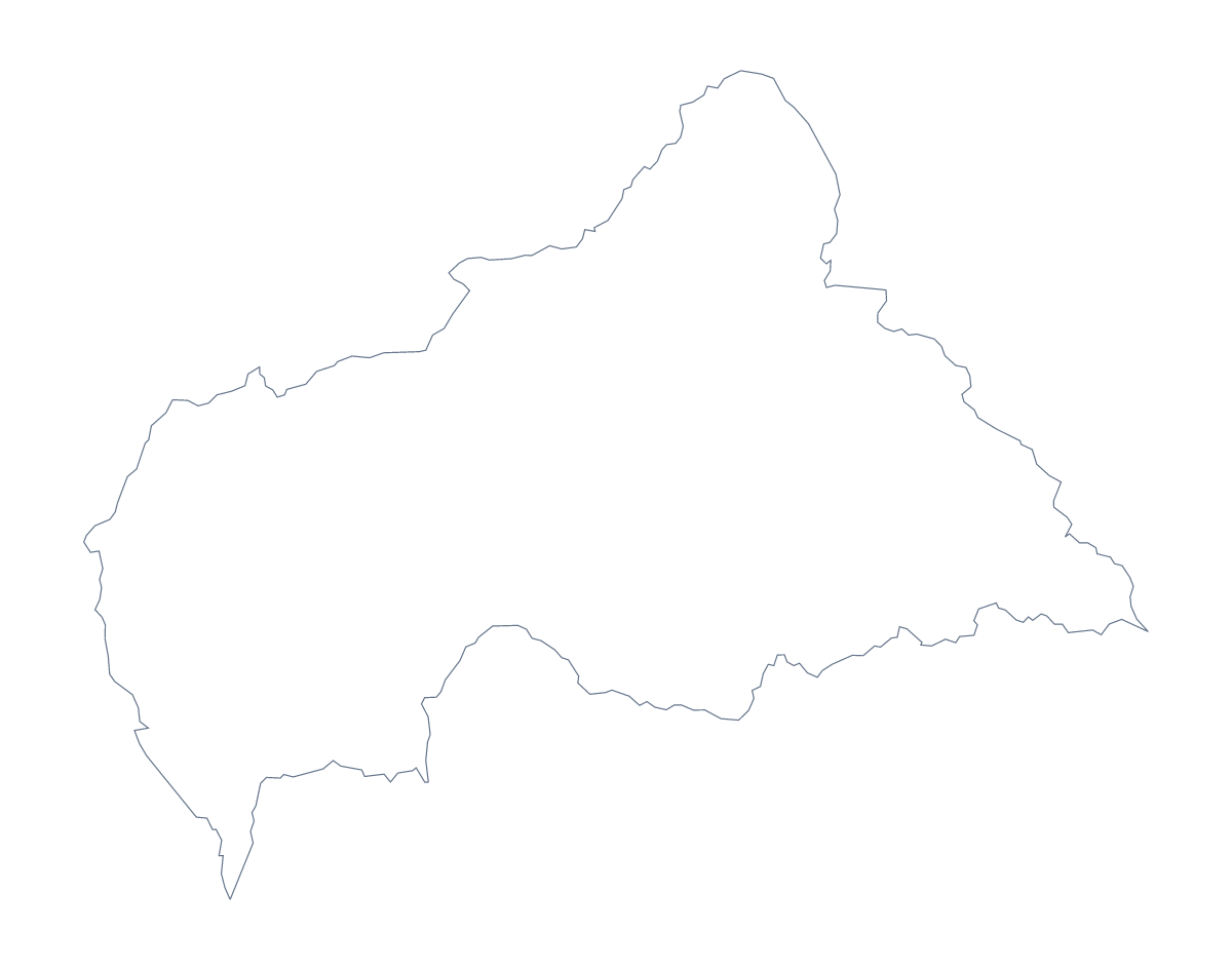
Using a blank map of the Central African Republic
Whoever needs the shape of the Central African Republic for something of their own will find two versions here: Outline only, the shape with nothing inside it, and With borders, which adds the 17 administrative areas. Each comes as a PNG on a transparent background, an SVG and a PDF.
A cover, a briefing slide, a quiz
A report on the country often opens with its outline on the cover, in one colour behind the title. Take the Outline only PNG and place it on a coloured block: the transparent background lets the block show around the shape. For a briefing, the With borders SVG can be restyled in a design tool so that areas a programme reaches carry a strong colour and the others a pale one.
For a quiz in your own worksheet, number six of the areas in a word processor, say Ouham, Kémo, Lobaye, Ouaka, Nana-Mambéré and Haute-Kotto, and keep the list of areas further down this page as the answer sheet. For a younger class, the Outline only PNG on a slide gives a plain shape to talk about before any names are added.
When the inner lines help
The political blank map of the Central African Republic is With borders: its 17 areas drawn, none named. Choose Outline only when the inner lines would get in the way, for a cover, a logo sketch or a silhouette to cut out.
Which file
Use the PNG for slides and worksheets, the SVG in design tools or when you need a large print, and the PDF for A4 or Letter. For names, a title or the neighbouring countries, Customise this map opens the same outline in the editor. To print sheets with colour and ink choices, see the printable map of the Central African Republic.
How to do it in MapMaker
- Choose With borders to show the 17 administrative areas, or Outline only for the shape alone.
- Download the SVG for a design tool, the PNG for a slide or a worksheet, or a PDF for A4 or Letter.
- Place the outline on your cover or slide; the transparent background takes the colour behind it.
- Number the areas you want pupils to name and check the answers against the list further down.
- For names or neighbouring countries on the map, choose Customise this map.
The 17 administrative areas on the map
A key for labelling the map by hand.
- Bamingui-Bangoran Prefecture
- Bangui
- Basse-Kotto Prefecture
- Haut-Mbomou Prefecture
- Haute-Kotto Prefecture
- Kémo Prefecture
- Lobaye Prefecture
- Mambéré-Kadéï
- Mbomou Prefecture
- Nana-Grébizi Economic Prefecture
- Nana-Mambéré Prefecture
- Ombella-M'Poko Prefecture
- Ouaka Prefecture
- Ouham Prefecture
- Ouham-Pendé Prefecture
- Sangha-Mbaéré
- Vakaga Prefecture
Facts about the Central African Republic
The Central African Republic is in Middle Africa. The capital is Bangui. The population is about 4.7 million (2019 estimate). The Central African Republic has an area of about 621,000 km². The largest cities are Bangui, Mbaïki, Bossangoa, Bambari and Berbérati. It borders Cameroon, Chad, Congo, Democratic Republic of the Congo, South Sudan and Sudan. The map divides it into 17 administrative areas.
Maps of neighbouring places
Questions people ask
Is there a political blank map of the Central African Republic?
Yes: it is the With borders version. It draws the lines between all 17 administrative areas with no names, so labels can be added by hand from the list of areas on this page.
Does the PNG have a transparent background?
Yes. Both the Outline only and the With borders PNG are on a transparent background, so a slide's own colour or photograph shows around the shape of the country.
Can I open the SVG in Illustrator, Inkscape or Figma?
Yes. The SVG is a vector file, so it opens in all three, and the country can be enlarged to poster size without the edges going soft. The area lines can be restyled or removed.
Can I show the countries around the Central African Republic?
Not on this page, which shows only the outline. Choose Customise this map to open the outline in the editor, where Neighbours draws the surrounding countries in grey.