Blank map of Russia
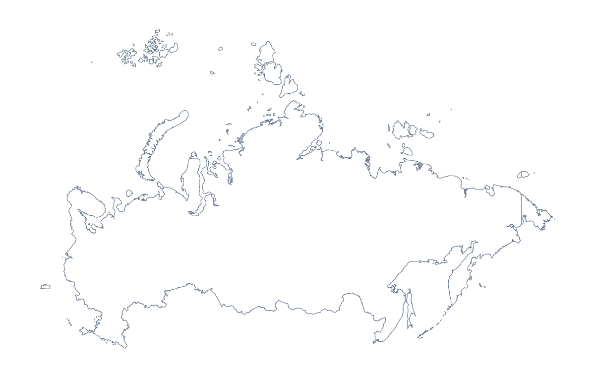
The outline, free as a PNG, SVG or PDF. Label it, colour it in or drop it into a slide.
Using a blank map of Russia
A blank map of Russia often ends up behind something else: figures on a slide, a timeline in a report, an illustration for an article, a worksheet that picks out one or two areas. Outline only gives the shape with nothing inside it; With borders adds the lines between its administrative areas. Both come as a PNG, an SVG and a PDF.
Behind a slide or an infographic
The transparent background of the PNG lets the outline sit on your theme colour with no box around it. At slide size, the many inner lines of With borders can look busy, so Outline only is usually the better backdrop for a title, a quote or three key figures. In the SVG, the outline can be redrawn with a heavier line, filled with one flat colour or used as a mask for a photograph in Figma, which makes a strong cover for a report or a talk.
A shape quiz with one area
Here is a starter that uses the inner lines. Open the SVG of With borders in a design tool, fill one area in a bright colour, such as Kaliningrad, Republic of Tatarstan or Sakha Republic, and leave the rest white. Pupils name the highlighted area from the list further down this page; repeat with a different area each lesson, and the list becomes the answer key for the whole set.
Posters and displays
For a poster, the SVG scales to any size without blurring, so the outline can fill a large sheet with room around it for notes and pictures. A design student can trace it, simplify it or set it in a single line weight for a stencil.
Which version, which file
Take With borders when the task is about the areas and Outline only when it is about the country as a whole shape. The PNG suits slides and documents, the SVG design tools and large prints, and the PDF a sheet on A4 or Letter as it stands. For black-and-white copies or a version shaded before printing, the printable map of Russia has the choices; for names or a title, Customise this map opens the editor.
How to do it in MapMaker
- Choose Outline only for a slide backdrop, or With borders when the task is about the areas.
- Download the SVG for Illustrator, Inkscape or Figma, or the PNG for a slide or a document.
- Resize the outline from a corner so it keeps its proportions on the page.
- Choose Customise this map to add names, colour some areas or set a title, and download the result from the editor.
The 85 administrative areas on the map
A key for labelling the map by hand.
- Altai Republic
- Altai Republic
- Amur
- Arkhangelsk
- Astrakhan
- Autonomous Republic of Crimea
- Bashkortostan
- Belgorod
- Bryansk
- Chechen Republic
- Chelyabinsk
- Chukotka Autonomous Okrug
- Chuvash Republic
- Irkutsk
- Ivanovo
- Jewish
- Kabardino-Balkaria
- Kaliningrad
- Kaluga
- Kamchatka Krai
- Karachay-Cherkess Republic
- Karelia
- Kemerovo
- Khabarovsk Krai
- Khanty-Mansi Autonomous Okrug
- Kirov
- Komi Republic
- Kostroma
- Krasnodar Krai
- Krasnoyarsk Krai
- Kurgan
- Kursk
- Leningrad
- Lipetsk
- Magadan
- Mari El Republic
- Moscow
- Moscow
- Murmansk
- Nenets Autonomous Okrug
- Nizhny Novgorod
- Novgorod
- Novosibirsk
- Omsk
- Orenburg
- Oryol
- Penza
- Perm Krai
- Primorsky Krai
- Pskov
- Republic of Adygea
- Republic of Buryatia
- Republic of Dagestan
- Republic of Ingushetia
- Republic of Kalmykia
- Republic of Khakassia
- Republic of Mordovia
- Republic of North Ossetia-Alania
- Republic of Tatarstan
- Rostov
- Ryazan
- Saint Petersburg
- Sakha Republic
- Sakhalin
- Samara
- Saratov
- Sevastopol
- Smolensk
- Stavropol Krai
- Sverdlovsk
- Tambov
- Tomsk
- Tula
- Tuva Republic
- Tver
- Tyumen
- Udmurt Republic
- Ulyanovsk
- Vladimir
- Volgograd
- Vologda
- Voronezh
- Yamalo-Nenets Autonomous Okrug
- Yaroslavl
- Zabaykalsky Krai
Facts about Russia
Russia is in Eastern Europe. The capital is Moscow. The population is about 140 million (2019 estimate). Russia has an area of about 16,900,000 km². The largest cities are Moscow, St. Petersburg, Novosibirsk, Yekaterinburg and Nizhny Novgorod. It borders Azerbaijan, Belarus, China, Estonia, Finland, Georgia, Kazakhstan, Latvia, Lithuania, Mongolia, North Korea, Norway, Poland and Ukraine. The map divides it into 85 administrative areas.
Maps of neighbouring places
Questions people ask
Can I make the outline bigger without it going blurry?
Yes. Download the SVG or a PDF: both are vector files, so the outline of Russia and the lines of its administrative areas stay sharp at poster size. The PNG is best kept at the size you place it.
Does the blank map show the names of the administrative areas?
No. A blank map has no names by design. The list of administrative areas further down this page names each one, and Customise this map opens the editor if you want names on the map.
What is the difference between Outline only and With borders?
Outline only is the shape of Russia alone, which reads well behind a title or a few figures. With borders adds the lines of its administrative areas, for labelling, colouring or picking out one area in a design tool.