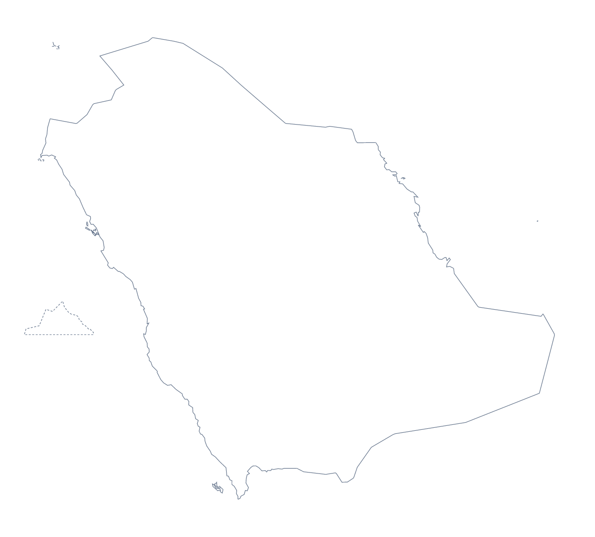
Blank map of Saudi Arabia
The outline, free as a PNG, SVG or PDF. Label it, colour it in or drop it into a slide.
Using a blank map of Saudi Arabia
Anyone who needs the shape of Saudi Arabia for something of their own will find two versions here: Outline only, the country on its own, and With borders, which draws its 13 administrative areas. Each is a PNG on a transparent background, an SVG and a PDF, ready for a worksheet, a briefing slide or a piece of artwork.
In a deck or a design
A regional manager can place the PNG on a slide with the company's colour behind it. The transparent background lets that colour show through, and a few pins or a line of figures can sit beside the shape. In Illustrator, Inkscape or Figma, the SVG of With borders gives 13 shapes you can fill one at a time, which suits a poster or a report cover with one area highlighted.
Worksheets and quizzes
The political blank map of Saudi Arabia is the With borders version, and it works as the base of a quiz. Paste the PNG into a document, number five areas, perhaps Al-Baha, Al-Jowf, Al-Qassim, Eastern and Makkah, and ask pupils to name each one; the list of areas further down this page is the answer sheet.
For younger pupils, Outline only is the better starting point: one shape, no inner lines.
Choosing the file
Take the PNG for documents and slides, the SVG for any design tool and the PDF when you want the outline on A4 or Letter. If the sheet needs names, pins or a title on the map itself, Customise this map opens the same outline in the editor. For paper copies in black and white, the printable map of Saudi Arabia is the place to start.
How to do it in MapMaker
- Choose Outline only for the shape, or With borders for the 13 areas.
- Download the PNG for a slide or document, the SVG for a design tool or a PDF for A4 or Letter.
- Place the file on your page and add numbers beside the areas you want named.
- Check the answers against the list of areas below the map.
- For names or a title on the map itself, choose Customise this map and download from the editor.
The 13 administrative areas on the map
A key for labelling the map by hand.
- 'Asir
- Al Madinah
- Al-Baha
- Al-Jowf
- Al-Qassim
- Eastern
- Ha'il
- Jazan
- Makkah
- Najran
- Northern Borders
- Riyadh
- Tabuk
Facts about Saudi Arabia
Saudi Arabia is in Western Asia. The capital is Riyadh. The population is about 34 million (2019 estimate). Saudi Arabia has an area of about 1,930,000 km². The largest cities are Riyadh, Jeddah, Dammam, Makkah and Medina. It borders Iraq, Jordan, Kuwait, Oman, Qatar, United Arab Emirates and Yemen. The map divides it into 13 administrative areas.
Maps of neighbouring places
Questions people ask
Is there a political blank map of Saudi Arabia?
Yes, the With borders version. It draws the lines between all 13 administrative areas and puts no names on them, so each can be labelled from the list further down this page.
Does the PNG have a transparent background?
Yes. The PNG has no background colour, so on a slide or worksheet only the outline of Saudi Arabia shows and the colour behind it comes through.
Can I open the SVG in Illustrator, Inkscape or Figma?
Yes. The SVG is a vector file, so it opens in all three and can be restyled, traced or scaled to poster size without blurring. The area lines are separate strokes you can recolour.
Can I show the countries around Saudi Arabia?
Not on this page, where the map does not change. Choose Customise this map and switch on Neighbours in the editor to draw the surrounding countries, then download from there.