Blank map of Europe
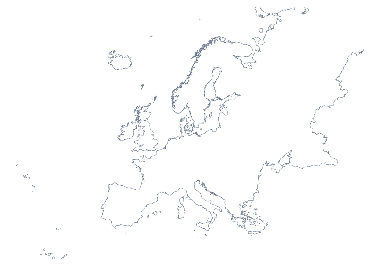
The outline, free as a PNG, SVG or PDF. Label it, colour it in or drop it into a slide.
Using a blank map of Europe
People who download an outline of Europe are mostly putting it into something of their own: a slide on European sales, a worksheet for a unit on the continent, a poster for a school trip, the header of a travel newsletter. With borders draws the 51 countries and territories; Outline only keeps the continent as one shape. Each version comes as a PNG on a transparent background, an SVG or a PDF.
A worksheet in your own layout
Paste the PNG of With borders into a word processor and set five postcards or photos the class has collected around it; pupils draw an arrow from each one to the country it came from, and the list further down this page settles any argument. For a harder round, use Outline only and ask pupils to draw in the borders of Germany, France and Poland from memory before they label them.
Decks and reports
For a European team, the transparent PNG sits on a title slide in the company's colours, with offices or market names beside it. In a report, a small outline of the continent in the corner of each page tells readers which region the figures cover.
Design work
The SVG opens in Illustrator, Inkscape or Figma, where every country of With borders is its own shape. Fill the countries a tour visits, set the rest in a pale tint and you have a gig poster or a trip graphic. Outline only makes a single silhouette for an icon, a stamp or a cut-out for a display board.
The version and the file
The political blank map of Europe is the With borders version, the one to take whenever the countries need telling apart. The PNG suits slides and documents, the SVG anything you will restyle or enlarge, and the PDF a copy for A4 or Letter. Black and white and other print choices are on the printable map of Europe; for names or colours, Customise this map opens the outline in the editor. The blank map of the European Union shows only the EU's members.
How to do it in MapMaker
- Choose With borders for the 51 countries and territories, or Outline only for the continent as one shape.
- Take the PNG for a worksheet or deck, or the SVG for a design tool.
- Use PDF, A4 or PDF, Letter if the outline is going straight to a printer.
- Choose Customise this map to add names or colours, then download from the editor.
The 51 countries and territories on the map
A key for labelling the map by hand.
- Åland
- Albania
- Andorra
- Austria
- Belarus
- Belgium
- Bosnia and Herzegovina
- Bulgaria
- Croatia
- Czechia
- Denmark
- Estonia
- Faroe Islands
- Finland
- France
- Germany
- Gibraltar
- Greece
- Guernsey
- Hungary
- Iceland
- Ireland
- Isle of Man
- Italy
- Jersey
- Kosovo
- Latvia
- Liechtenstein
- Lithuania
- Luxembourg
- Malta
- Moldova
- Monaco
- Montenegro
- Netherlands
- North Macedonia
- Norway
- Poland
- Portugal
- Romania
- Russia
- San Marino
- Serbia
- Slovakia
- Slovenia
- Spain
- Sweden
- Switzerland
- Ukraine
- United Kingdom
- Vatican City
Facts about Europe
Europe has 51 countries and territories on the map. The most populous are Russia, Germany, France, United Kingdom, Italy, Spain, Ukraine, Poland, Romania and Netherlands.
Maps of places in Europe
Questions people ask
Is there a political blank map of Europe?
Yes, the With borders version. It draws the borders between the 51 countries and territories on the map with no names, so each country is a separate shape you can number, fill or label.
Which file should I use in a worksheet, a slide or a design?
The PNG for a worksheet or a slide, since its transparent background takes the colour behind it. The SVG for Illustrator, Inkscape or Figma, where the map of Europe can be restyled and enlarged. The PDF to print as it is.
Is there an answer key for a labelling quiz?
Yes. The list of countries further down this page names all 51 countries and territories on the blank map of Europe, so you can number some on the outline and use the list to check the answers.