Blank map of the Mediterranean
The outline, free as a PNG, SVG or PDF. Label it, colour it in or drop it into a slide.
Using a blank map of the Mediterranean
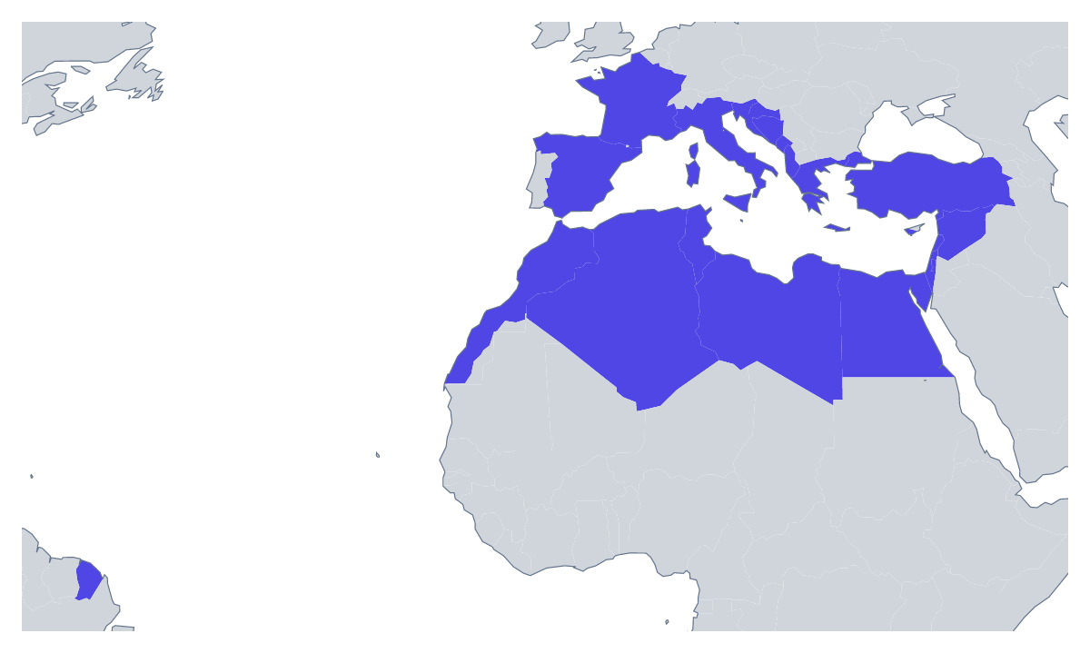
The shape of the Mediterranean works as the cover of a travel brochure, a banner for a restaurant group, the backdrop for a shipping update or the header of a classroom unit. With borders gives you the 22 countries as separate shapes; Outline only keeps the land as one. Take either as a PNG on a transparent background, an SVG or a PDF.
Brochures and banners
Lay the transparent PNG over a photograph or a block of blue and the countries sit on it with no box around them. A tour company can set it on the first page of a brochure and write the route over the top; a food business can fill it with an accent colour behind a menu title.
Design work
In Illustrator, Inkscape or Figma the SVG scales to any size. A designer can restyle the borders in a brand colour, fill the countries a campaign covers and leave the others pale, or trace the outline into a line drawing for a wall piece. It is also the file to send to a cutter or a printer.
Menus and itineraries
A restaurant group or a travel writer can set the PNG at the top of a menu or an itinerary, write the stops over it in your own font and fill the countries visited in one accent colour. The list further down this page gives the 22 countries by name if you need to check a spelling.
Which version
With borders is the political blank map of the Mediterranean: pick it whenever countries must be told apart. Outline only is the silhouette, best when the map is small or decorative. Use the PNG on slides, the SVG for design and a PDF for A4 or Letter. To add names, colours or a route, start from the editable map of the Mediterranean.
How to do it in MapMaker
- Choose With borders for the 22 countries, or Outline only for the region as one shape.
- Download the PNG for a document or slide, or the SVG for a design tool.
- Use PDF, A4 or PDF, Letter to print the outline as it is.
- Open Customise this map to add names, colours or a title, then download from the editor.
The 22 members on the map
A key for labelling the map by hand.
- Albania
- Algeria
- Bosnia and Herzegovina
- Croatia
- Cyprus
- Egypt
- France
- Greece
- Israel
- Italy
- Lebanon
- Libya
- Malta
- Monaco
- Montenegro
- Morocco
- Palestine
- Slovenia
- Spain
- Syria
- Tunisia
- Turkey
Facts about the Mediterranean
This map shows the countries with a coast on the Mediterranean Sea. 22 members are on the map.
Maps of places in the Mediterranean
Questions people ask
Is there a political blank map of the Mediterranean?
Yes: the With borders version. It draws the lines between the 22 countries on the map and puts no names on them, so every country is a separate shape for you to colour, style or name.
Which countries are on the blank map of the Mediterranean?
22 countries, from Spain, France and Italy to Turkey, Egypt and Morocco. The list further down this page names each one and can be used as the key.
Can I open the SVG in Illustrator, Inkscape or Figma?
Yes. The SVG is a vector file, so the outline and the country borders stay sharp at any size, and any country can be recoloured or given a new line weight in a design tool.